• About JacobBarlow.com
  • Cemeteries in Utah
  • D.U.P. Markers
  • Doors
  • Exploring Utah Email List
  • Geocaching
  • Historic Marker Map
  • Links
  • Movie/TV Show Filming Locations
  • Oldest in Utah
  • Other Travels
  • Photos Then and Now
  • S.U.P. Markers
  • U.P.T.L.A. Markers
  • Utah Cities and Places.
  • Utah Homes for Sale
  • Utah Treasure Hunt

JacobBarlow.com

~ Exploring with Jacob Barlow

JacobBarlow.com

Tag Archives: utah

William H. McIntyre House

20 Thursday Nov 2025

Posted by Jacob Barlow in Uncategorized

≈ Leave a comment

Tags

Avenues Historic District, NRHP, Salt Lake City, Salt Lake County, utah

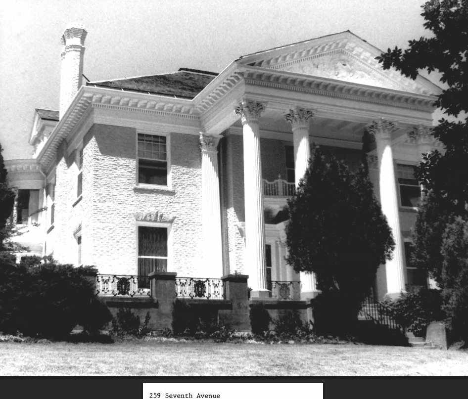
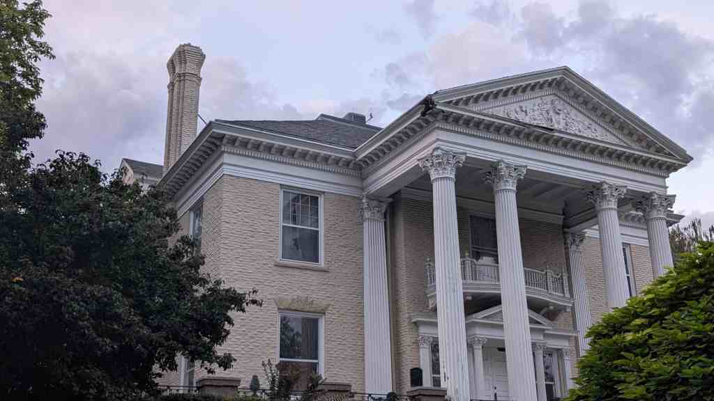
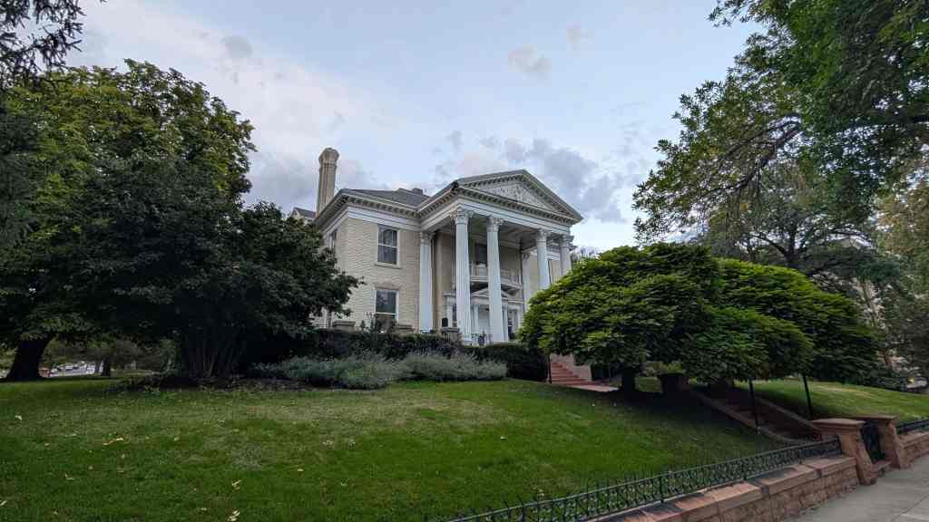
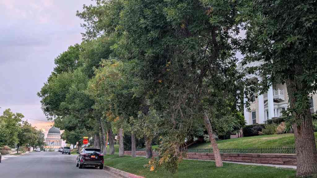
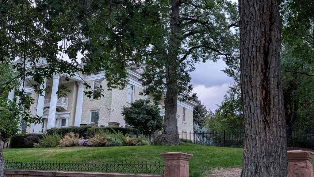
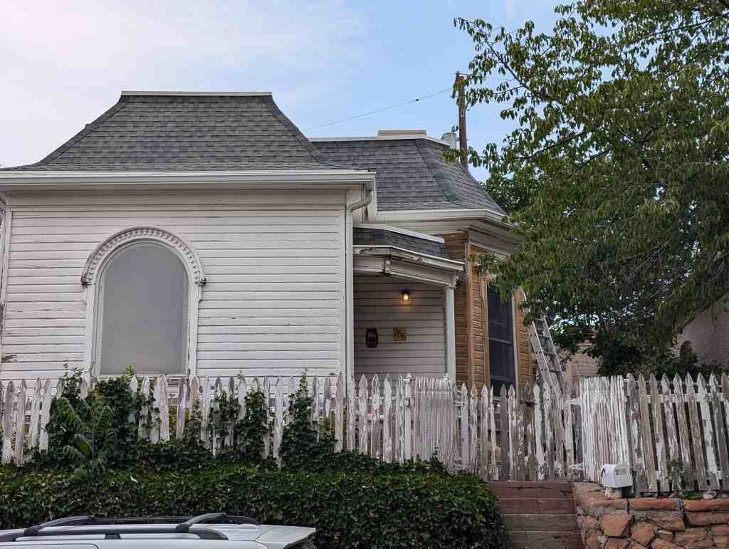
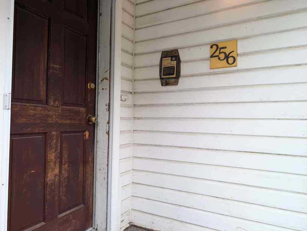
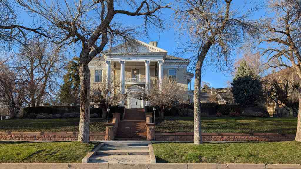
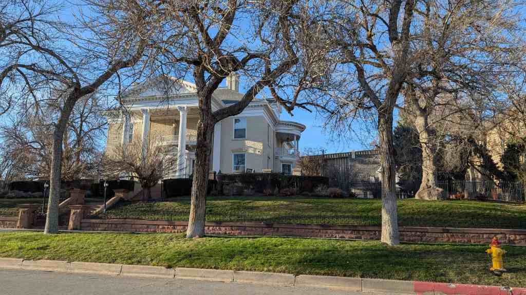
The McIntyre House, located at 259 East Seventh Avenue in The Avenues in Salt Lake City, Utah was added to the National Register of Historic Places (#78002677).

The property on which the McIntyre House sits was registered to C. J. Sandbech on June 27, 1874, as lot 2, Block 101, Plat D. The lot was purchased by Gill S. Peyton on January 26, 1894, for a price of $2,500.00.

The structure was designed by architect Fredrich Hale and was first inhabited in 1898 and was called Payton Hall. The property, house, and carriage house was sold to Henry w. Brown on July 18, 1900, for a price of $15,000.00.

William H. McIntyre acquired the house on December 5, 1901 for a price of $19,000.00 and the adjacent lot (Lot #2) for a price of $2,000.00. From this date on the structure has been known as the Mclntyre House.

Service connections are recorded as being made on April 17, 1906 and additional services and repairs were made August 8, 1910.

William H. Mclntyre died on August 20, 1926. Mrs. Phoebe McIntyre resided in the house until her death in 1945. William H. McIntyre came to Utah as a boy from Texas and his adventurous life was bound up with the development of the Utah cattle business. In later life Mr. McIntyre developed large holdings in Alberta, Canada, where he established the McIntyre Ranch but he retained many interests in Utah and spent his last years there; dying in Salt Lake City in 1926 at ‘the age of ‘seventy-eight.

He was born in Grimes County, Texas about forty miles, north of what is now the city of Houston, in the year 1848, the son of William McIntyre who was of Scotch-Irish descent.

William’s brother, Samuel, along with William traveled to Texas about 1870 to sell some property owned by, t;heir father. After the sell was completed they bought cattle and made the long trek back to Utah. In the spring of the next year, they sold the cattle for more than five times what they had paid. This gave them enough money to buy more cattle in Omaha and drive them to Utah. This partnership continued until sometime in the 1880s and gave the two brothers enough money to enter into several ventures, including the Mammoth Mine at Mammoth, Utah which then developed into a successful operation.

During the 1880s, William had hard times in the cattle business losing almost an entire herd in the winter of 1886-87. In 1891 to 1894 William began investigating the possibility of purchasing land and in 1894 he purchased a full section of land near Cardston in Alberta, Canada. Ranching began shortly after the purchase.

William H. McIntyre was married to Phoebe, Ogden Chase. She was the granddaughter of Isaac Chase, the first flour miller in Utah. Liberty Park was once the Isaac Chase farm, later passing to Brigham Young. Phoebe Chase was torn at the caretaker’s house which still stands on Liberty Park.

Mentioned in the national register’s nomination form:
While they account for less than one percent of all residences, the very large, often architect-designed homes in the Eastlake, Queen Anne and Shingle styles, and later the Prairie and Craftsman styles greatly influence the visual character of the Avenues. Some of the state’s best examples of residential architectural styles were built there, including the William Barton house, 231 B Street, (vernacular/Gothic); the Jeremiah Beattie house, 30 J Street, (Eastlake); the David Murdock house, 73 G Street, (Queen Anne); the E.G. Coffin house, 1037 First Avenue, (Queen Anne); the N.H. Beeman house, 1007 First Avenue, (Shingle style); the Vto. Mclntyre house, 257 Seventh Avenue, (Classical Revival); the James Sharp house, 157 D Street, (Craftsman); and the W.E. Ware house, 1184 First Avenue, (Colonial Revival).

Gregerson Family Cemetery

18 Tuesday Nov 2025

Posted by Jacob Barlow in Uncategorized

≈ Leave a comment

Tags

Cemeteries, utah, Washington County

The Gregerson Family Cemetery in Pintura, Utah

Settlement of Eden

16 Sunday Nov 2025

Posted by Jacob Barlow in Uncategorized

≈ Leave a comment

Tags

DUP, Eden, Historic Markers, utah, Weber County

Settlement of Eden

The town of Eden was named after the biblical Garden of Eden. Before Eden was surveyed and laid out in 1865, the valley was the summer hunting grounds for Shoshone Indians. As early as 1825, trappers of the Hudson Bay Fur Company, led by Peter Skene Ogden, followed Indian trails throughout the valley, then known as Ogden’s Hole.

Brigham Young, president and leader of The Church of Jesus Christ of Latter-day Saints, sent a group of cattlemen to the valley in 1854. They found the valley excellent for their cattle, corralled naturally by the mountains with plenty of feed and water. Erastus Bingham and Joseph Hardy built cabins in 1857 on the slopes below what was later called Geertsen Canyon. Sydney Teeples built a cabin on the North Fork, and Stephen K. Wilbur settled in the area that later became Eden. The first permanent settlers came over North Ogden Pass in 1859. The winters were long and harsh, with the snow reaching six feet deep in places and the temperature as low as 46 degrees below zero.

The Utah Black Hawk War in 1865 caused the pioneers to move closer together. They settled into the area between the Middle Fork and the North Fork rivers and named their new town Eden. The center block was the public square. The population soon grew to 250 people.

A one-room log school house was built across from the square in 1866. It was used until 1884 when a larger frame building was built. A bell called the children to school, announced the noon hour and the end of recess, and also warned the people of fires or other emergencies. When a new yellow brick school replaced the smaller structure, the bell was mounted on the roof. The bell is now mounted on this monument.

Daughters of Utah Pioneers historic marker #538, located in Eden Park at 5509 East 2200 North in Eden, Utah.

  • D.U.P. Historic Markers

Mary Smith House

13 Thursday Nov 2025

Posted by Jacob Barlow in Uncategorized

≈ Leave a comment

Tags

Historic Homes, NRHP, utah

Mary Smith House

The Mary Smith House, a brick cross-wing Victorian, built c. 1883, is historically significant as one of the few houses in Draper built to accommodate a polygamous family and is the only known house in the community built specifically to comply with the 1882 Edmunds Act, which outlawed “cohabitation”. one man sharing his house with more than one wife. The Edmunds Act was one of the major steps taken by the federal government to force the Mormon Church into giving up polygamy. The house was likely built to protect Lauritz Smith, Mary’s husband, from prosecution. Mary, Lauritz’s first wife, moved into this house, while Hannah, the second wife, remained in the family home less than a quarter-mile away.

12423 South Relation Street (1565 East) in Draper, Utah

Mary Smith Home

This home was built c. 1883 for Mary Smith, the first wife of Lauritz Smith, Draper’s first blacksmith. Married in 1854, the young Danish couple arrived in Draper in 1855. Their first log home was replaced by a new brick home built c. 1865-1867 located about 1/4th mile west of this site on Pioneer Ave. and still standing. Lauritz took a 2nd wife, Hannah Jensen, in 1867.

With the passage of the Edmunds Act in 1882, it became unlawful for a man to “cohabitate”. Lauritz and his son, Joseph, built this house for Mary. This is the only known house in Draper built specifically to comply with the Edmunds Act. The home is presently owned by a descendant, Karen Smith.

William A. Byers Home

30 Thursday Oct 2025

Posted by Jacob Barlow in Uncategorized

≈ Leave a comment

Tags

NRHP, Salt Lake City, Salt Lake County, utah

William A. Byers Home

Home built 1891 for William A. Byers. Frame construction with mansard roof. Registered October 3, 1973 by Messrs Randall K. Jensen and Lamont B. Vail.

256 North Vine Street in Salt Lake City, Utah

(county records)

Emery County Court House

23 Thursday Oct 2025

Posted by Jacob Barlow in Uncategorized

≈ Leave a comment

Tags

Castle Dale, Courthouses, Emery County, New Deal Funded, utah, WPA

Emery County Court House built in 1938-39 as one of Utah’s WPA New Deal Projects.

95 East Main Street in Castle Dale, Utah

Welcome to Lode – Adventures of Power Filming Location

09 Thursday Oct 2025

Posted by Jacob Barlow in Uncategorized

≈ 1 Comment

Tags

Carbon County, Filming Locations, Helper, utah

Welcome to Lode – Adventures of Power Filming Location

This is the location for multiple scenes on the movie showing the entrance to the fictional town of Lode, New Mexico from the movie Adventures of Power (2008).

It was filmed in Helper, Utah.

Related:

  • Adventures of Power Filming Locations
  • Movie/TV Show Filming Locations

Grotto Camping Ground North Comfort Station

30 Tuesday Sep 2025

Posted by Jacob Barlow in Uncategorized

≈ Leave a comment

Tags

NRHP, utah, Washington County, Zion National Park

Grotto Camping Ground North Comfort Station

The Grotto Camping Ground North Comfort Station is located in Zion National Park in Washington County, Utah and was added to the National Historic Register (#86003705) on February 14, 1987.

Wendover Air Force Base

25 Thursday Sep 2025

Posted by Jacob Barlow in Uncategorized

≈ Leave a comment

Tags

Air Force, Air Force Bases, Military, Military Bases, NRHP, Tooele County, utah, Wendover

Wendover Air Force Base

Related:

  • Historic Wendover Field

The Wendover Air Force Base is located in south Wendover, Utah and was added to the National Register of Historic Places (#75001827) on July 1, 1975. The following text is from the nomination form for the historic register:

The history of the base began in 1939 when the Air Corps commenced an extensive expansion program. High on the priority list v/ere adequate bombing and gunnery ranges.

By 1940 a site was located at Wendover. The Air Corps desired some 3,000,000 acres of land 90% of which was public domain. However, because of grazing commitments, the Interior Superintendent was willing to release only 1,500,000 acres. Livestock men in the area suggested that another site be selected or the area reduced in size. They estimated that use of the 1 1/2 million acres would “wipe out 100 outfits” of livestock men and cost the state about $1,500,000 annually.

Despite these objections, work began on the base in November 1940. Temporary barracks were constructed and two 150 x 7000′ runways with taxi strips and anchorage areas were graded and graveled. In May 1941, the areas were paved and more extensive construction began.

The first training unit arrived at Wendover April 6, 1942 and found the area ideal for bombing and gunnery practice. Because of the abundance of salt, obtainable from the nearby Bonneville Salt Flats, a city of salt was constructed near the mountains for bombing practice.

The historical significance of the base is its role as the training site for the 509th Group under the command of Colonel Paul W. Tibbets, Jr. It was Colonel Tibbets, flying his B-29, “The Enola Gay,” who dropped the atomic bombs on Hiroshima and Nagasaki in August 1945.

The 509th Group was organized December 17, 1944 and trained at Wendover until May of 1945 when it left for Tenian Island in the Marianas. During its stay at Wendover, the group was housed in a maximum security area. Information about the group’s mission was so restricted that even members of the 509th did not know the purpose of this training.

Although the bombing of Hiroshima and Nagasaki has been regarded by some people as a means too terrible even for use in world wide conflict, it did bring to an end the war with Japan. The crew of the u Enola Gay’ proved that an atomic bomb could be used under combat conditions. The threat of its future use served the United States as an important post war foreign policy tool. For its role in ushering in the Atomic Age, the Wendover Air Force Base deserves recognition.

Wendover Air Force Base is located just south of the town of Handover, Although presently unoccupied the base chapel, hospital, barracks, administration offices, hangars, and other buildings remain.

The fire station is still in use by the base caretakers–the base was closed by the Air Force in 1963. One runway is still in use for commercial and private air traffic into Wendover. The Air Central building serves as headquarters for this limited use of the base.

The barricaded area, where the crew of the Enola Gay was housed, remains on the south side of the base separated from the other buildings by the runways.

The buildings which do remain were built in the typical World war II temporary military use style. They are frame buildings and, since 1963, have deteriorated from lack of use.

At present the state of Utah is attempting to acquire the air base site. Several businesses have expressed an interest in using the air base buildings for offices and warehouses. The runway will continue to serve as Wendover’s airport.

Howe Flume Historic District

21 Sunday Sep 2025

Posted by Jacob Barlow in Uncategorized

≈ Leave a comment

Tags

Historic Districts, NRHP, summit county, utah

Howe Flume Historic District

The Howe Flume Historic District was added to the National Register of Historic Places (#78002695) on December 12, 1978.

Related:

  • Utah’s Historic Districts
← Older posts

Follow Jacob

Follow Jacob

Blog Stats

  • 1,893,097 hits

Social and Other Links

BarlowLinks.com

Recent Posts

  • 420 E South Temple
  • 328 1st Avenue
  • 324 1st Avenue
  • 108 L Street
  • 971 3rd Avenue

Archives


Loading Comments...