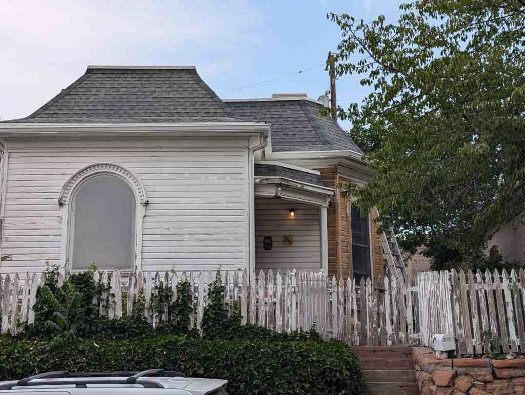
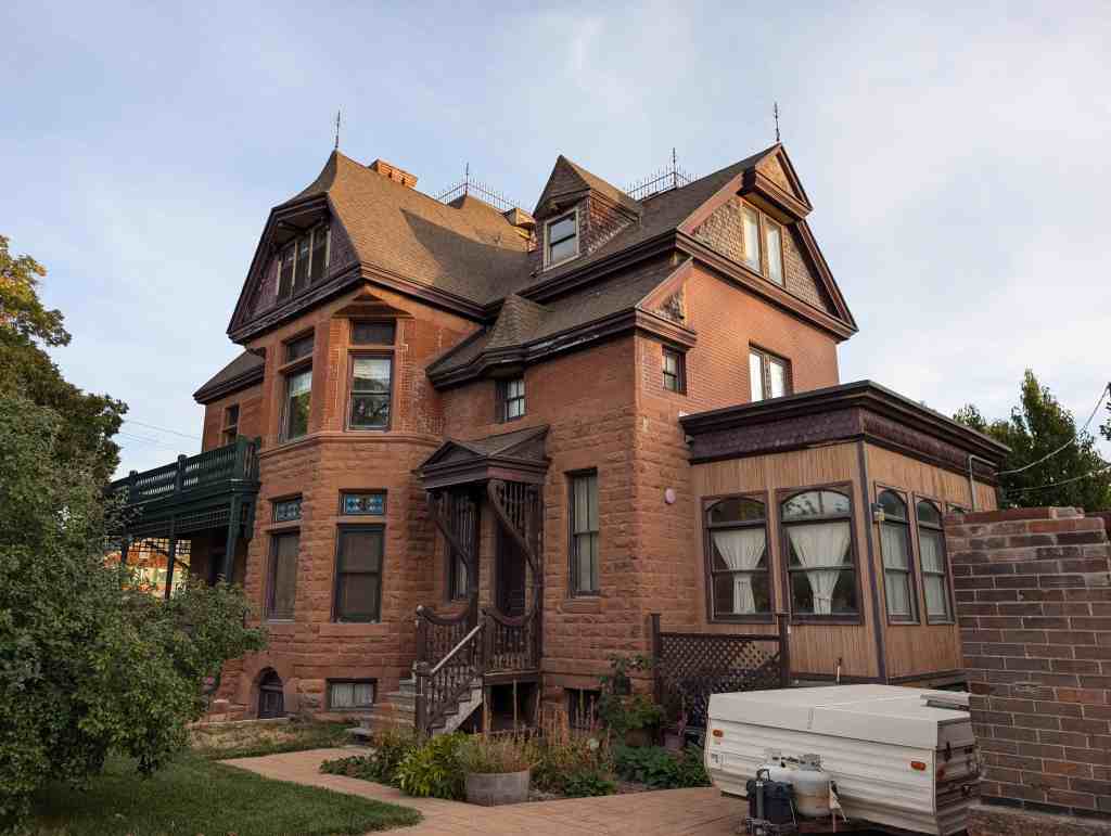
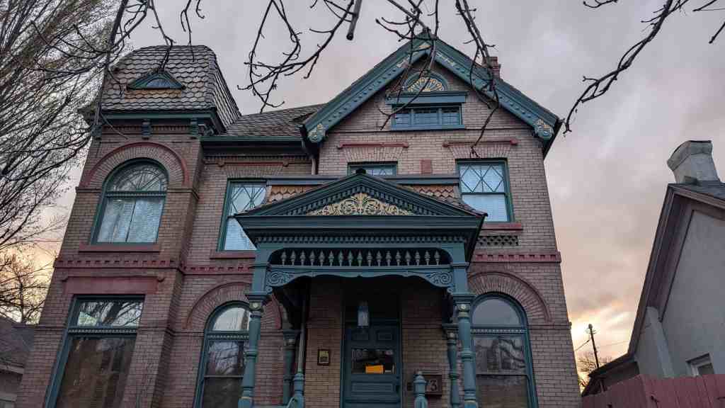
The property on which the McIntyre House sits was registered to C. J. Sandbech on June 27, 1874, as lot 2, Block 101, Plat D. The lot was purchased by Gill S. Peyton on January 26, 1894, for a price of $2,500.00.
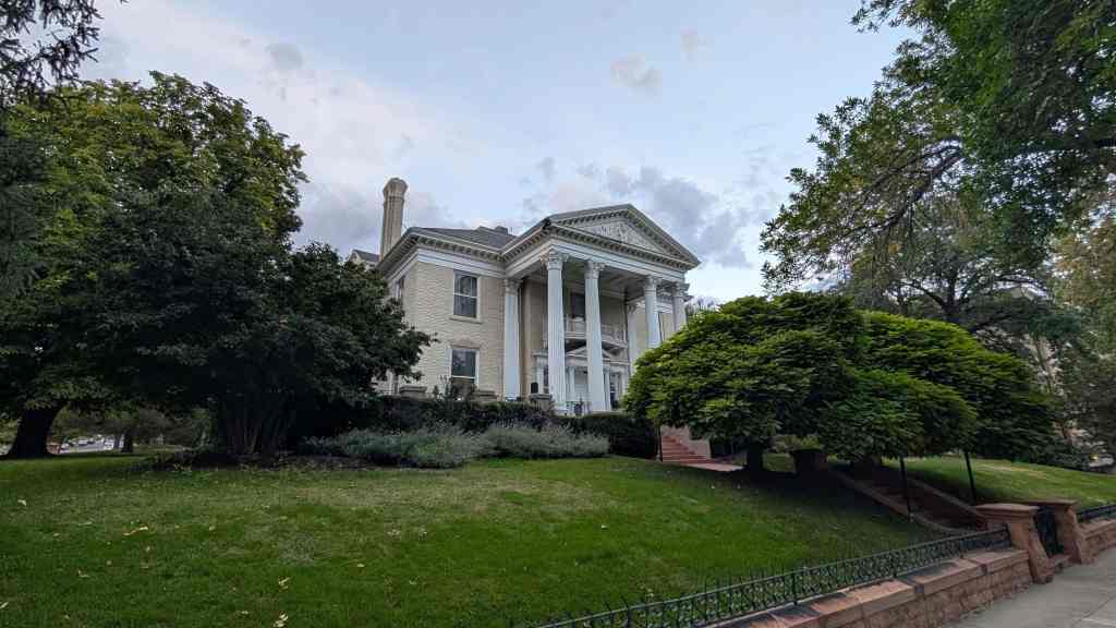
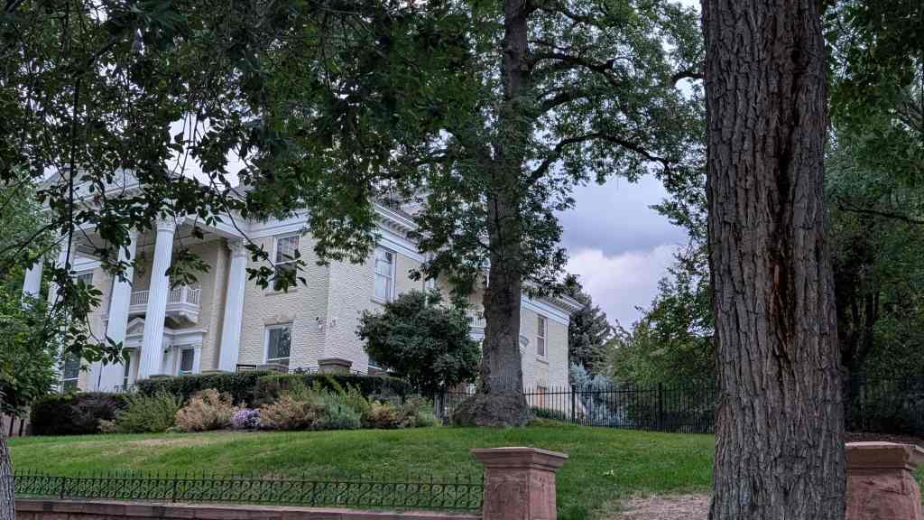
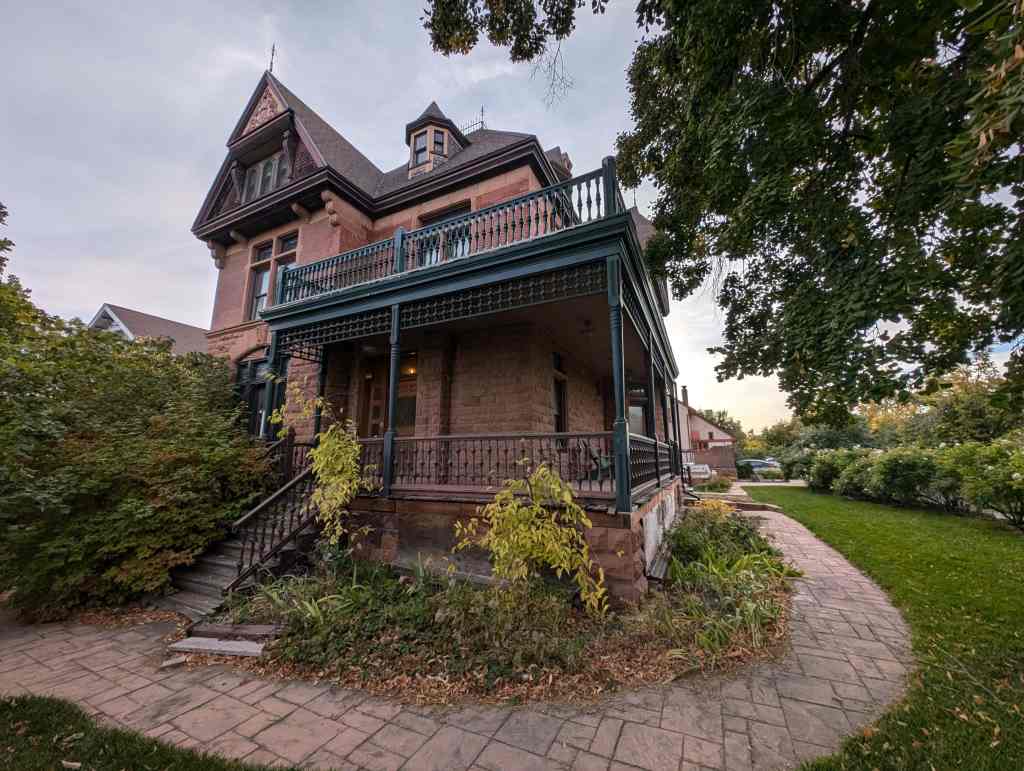
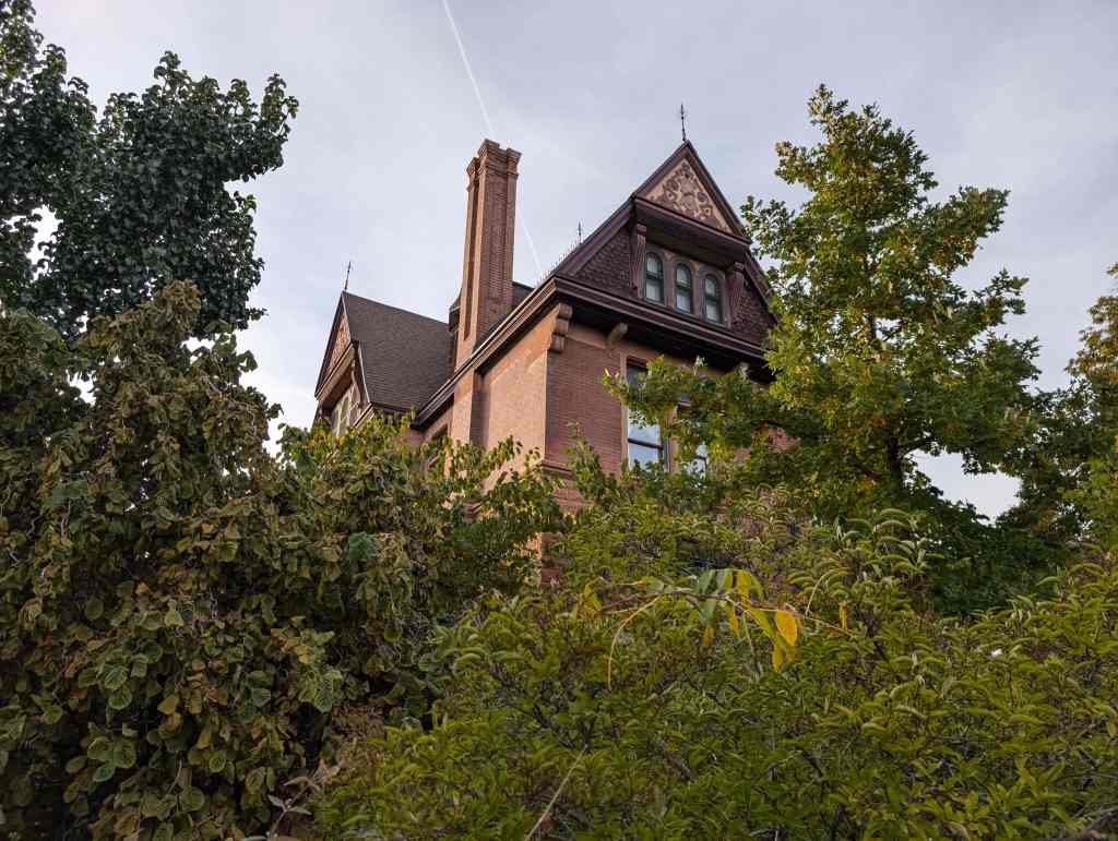
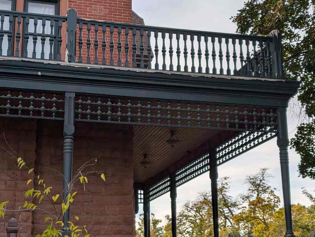
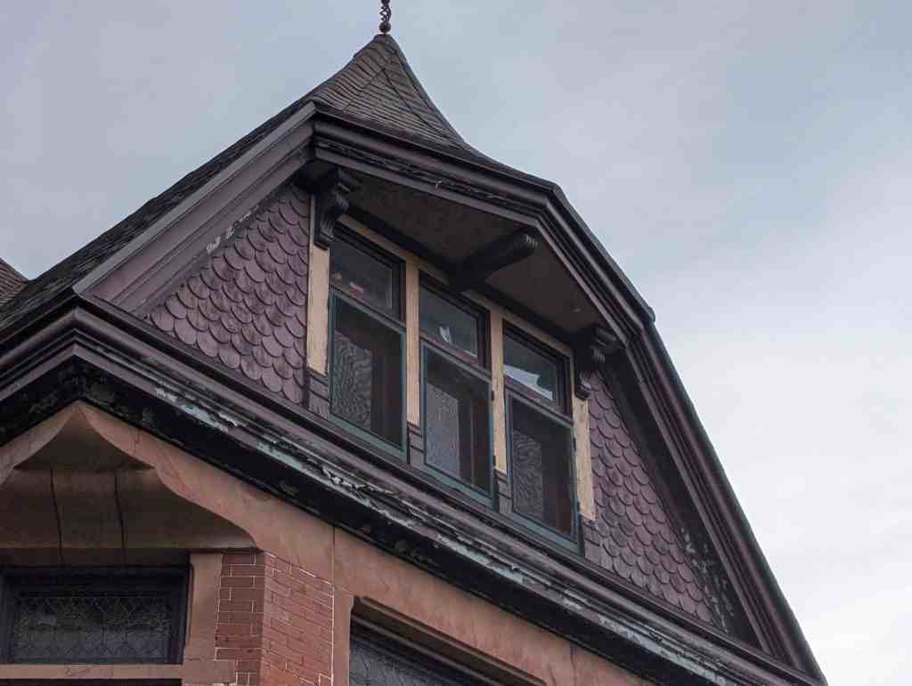
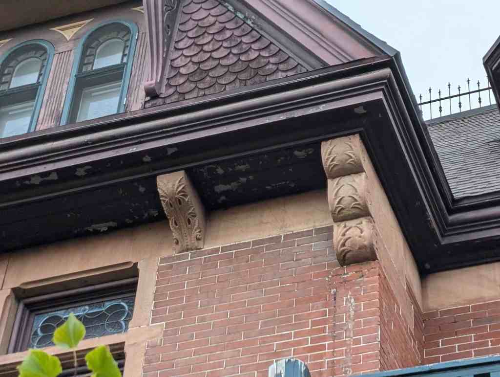
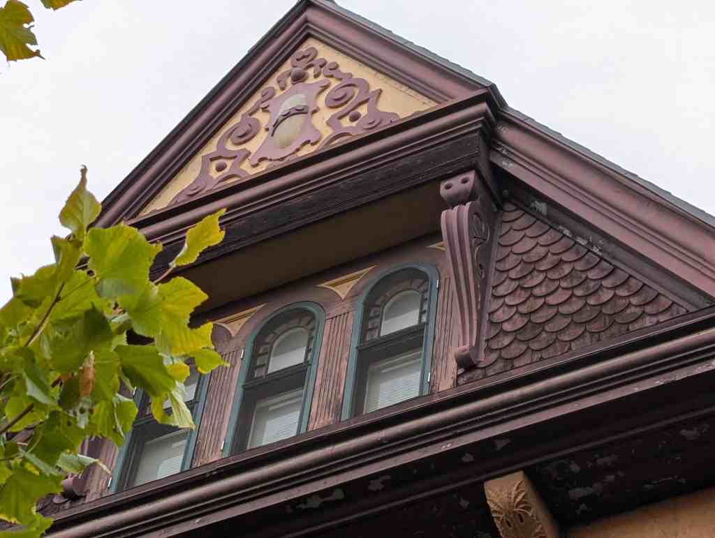
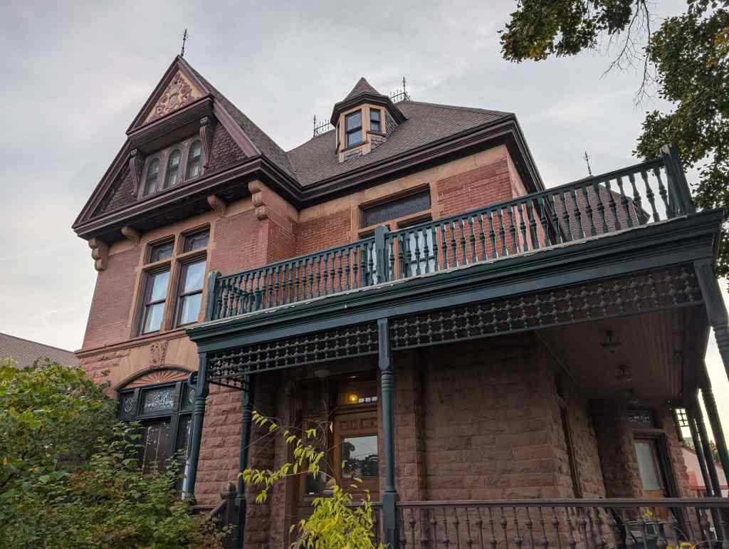
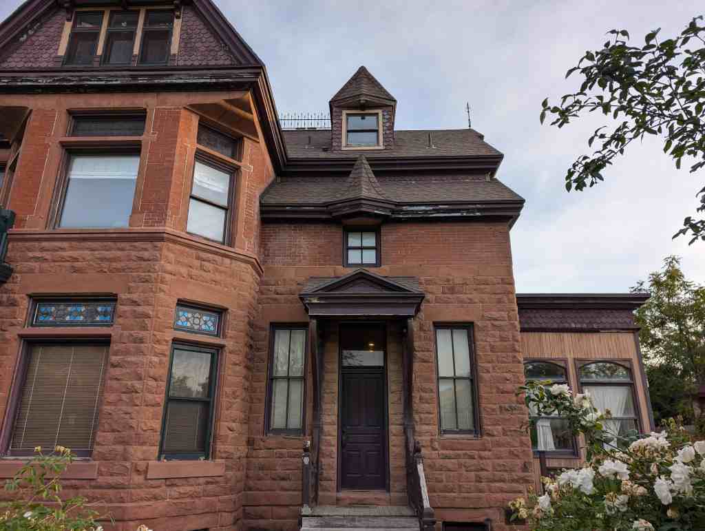
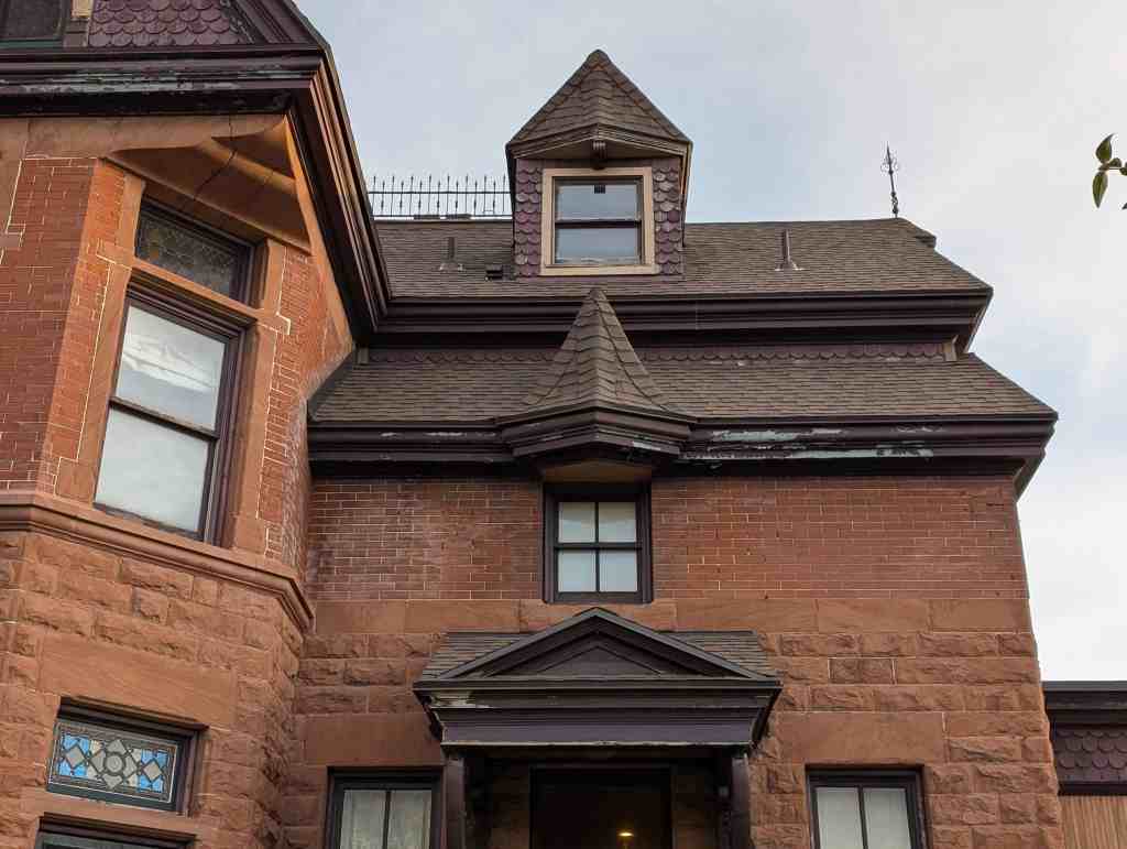
The structure was designed by architect Fredrich Hale and was first inhabited in 1898 and was called Payton Hall. The property, house, and carriage house was sold to Henry w. Brown on July 18, 1900, for a price of $15,000.00.
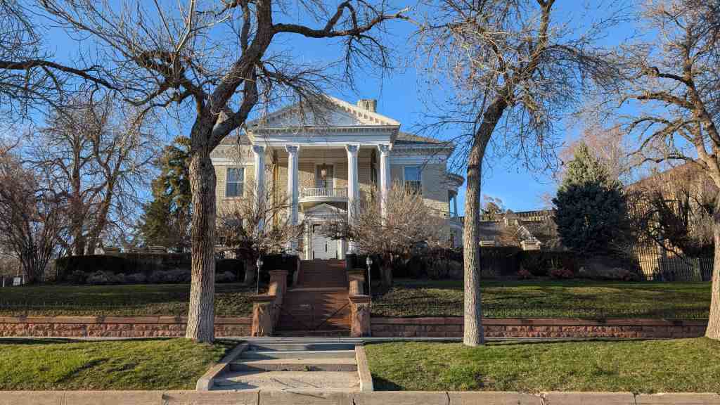
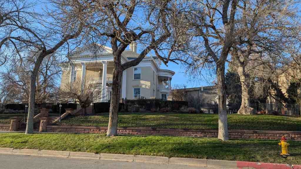
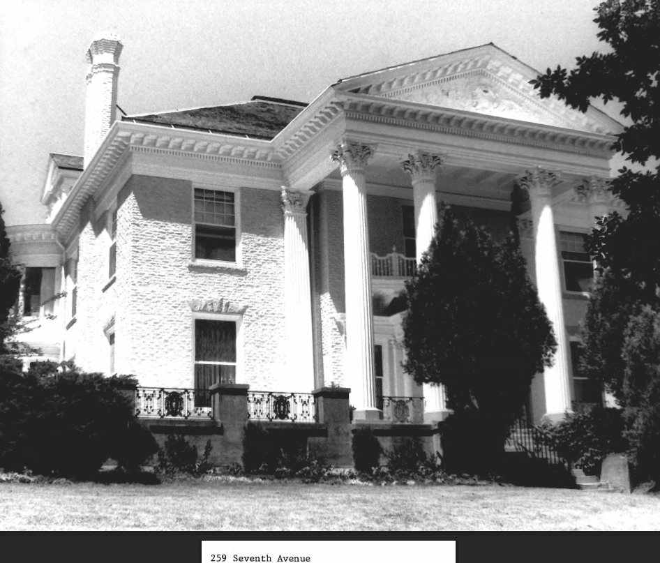
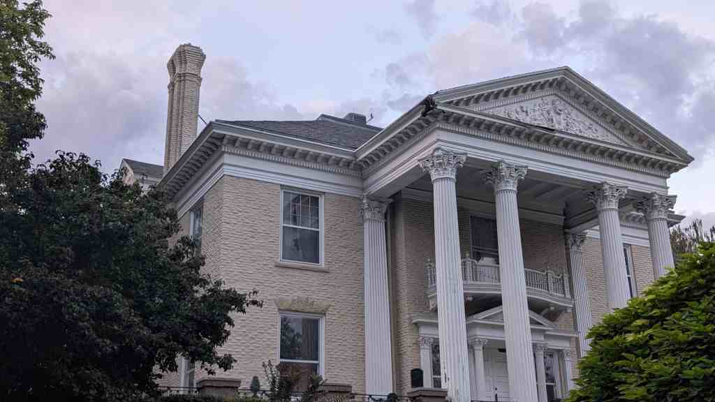
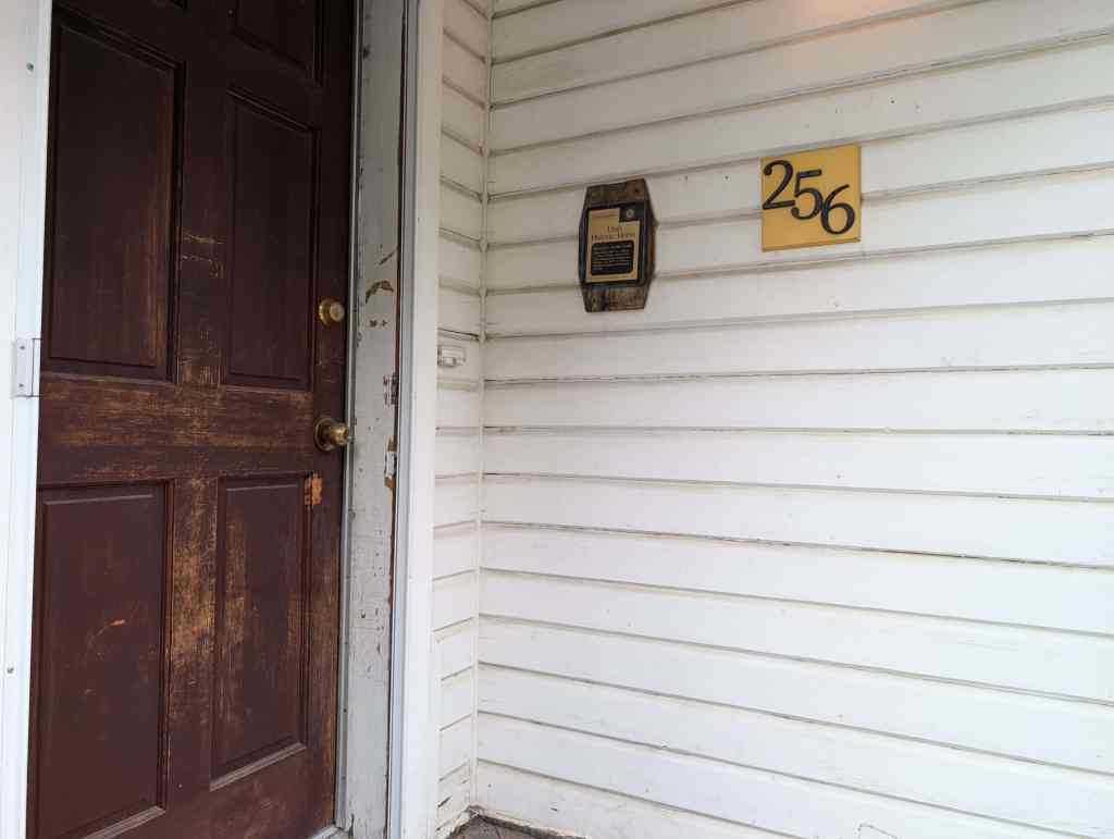
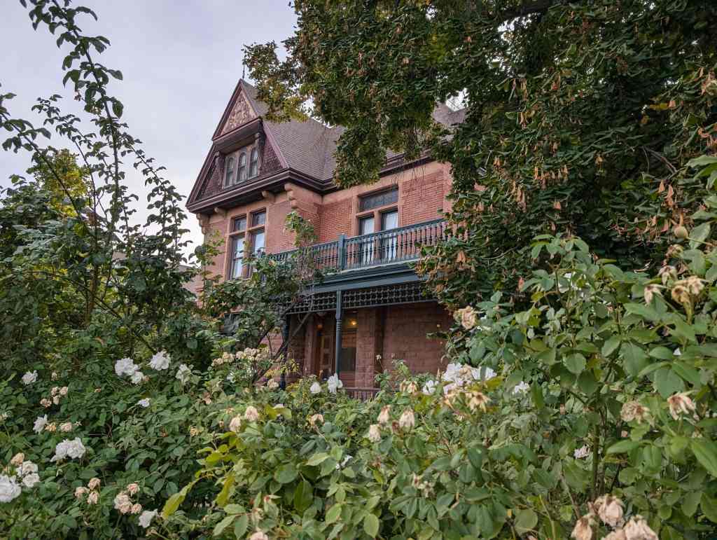
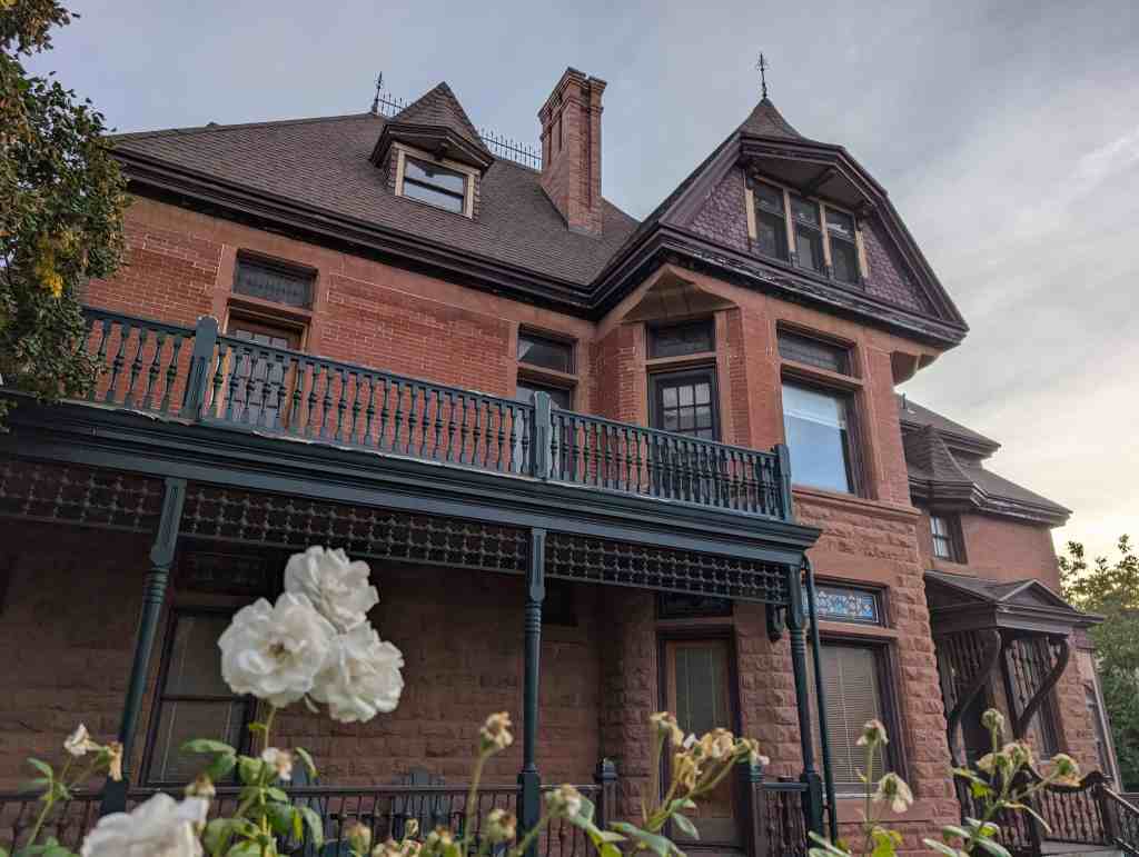
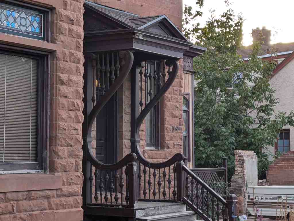
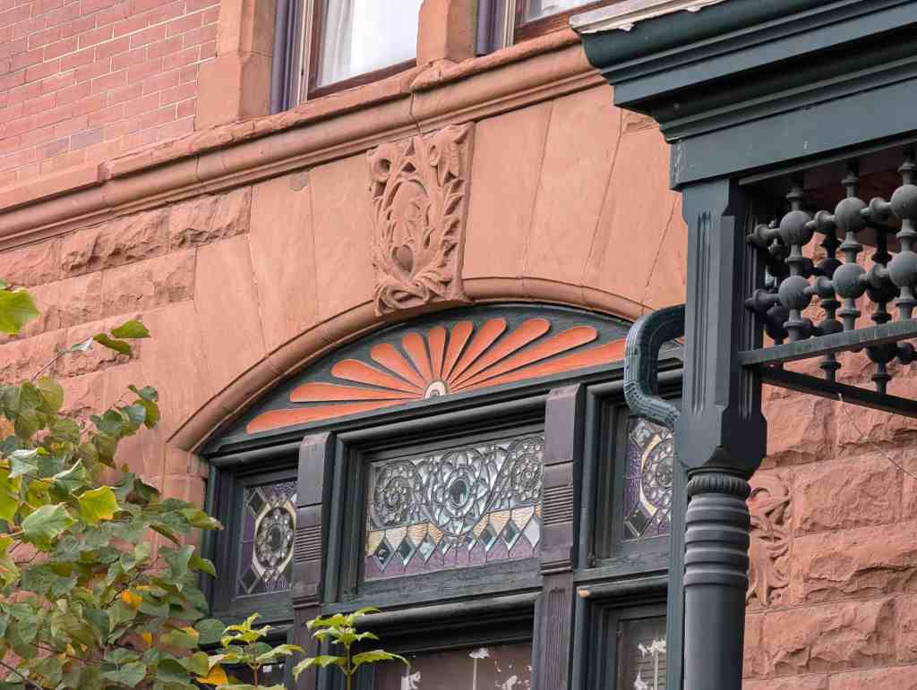
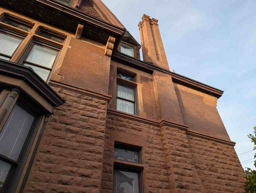
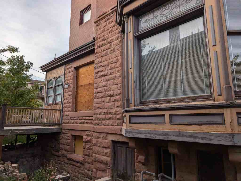
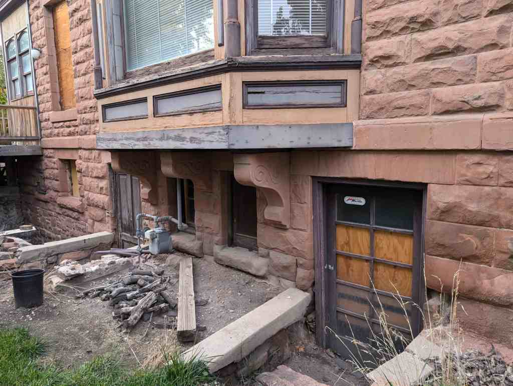
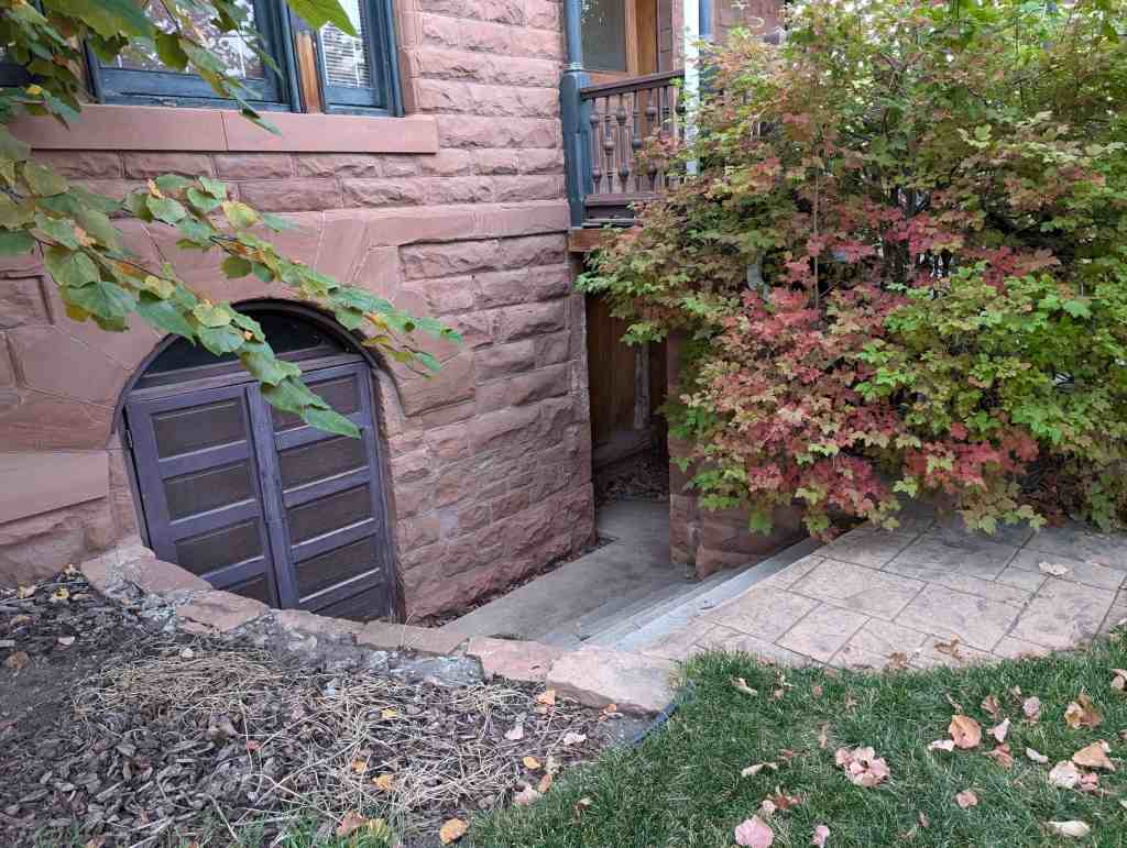
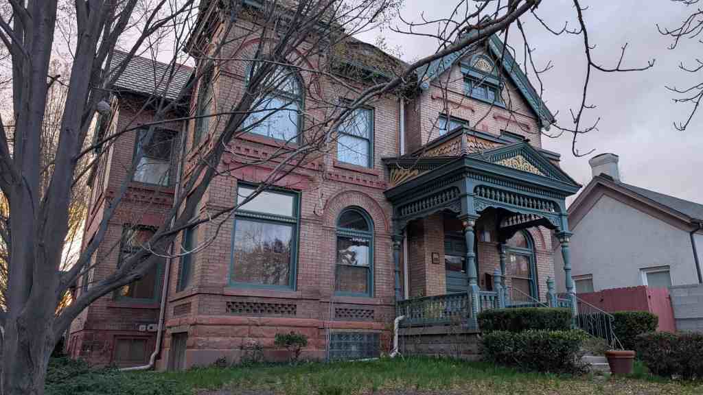
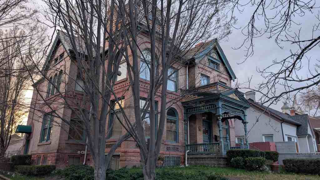
William H. McIntyre acquired the house on December 5, 1901 for a price of $19,000.00 and the adjacent lot (Lot #2) for a price of $2,000.00. From this date on the structure has been known as the Mclntyre House.
Service connections are recorded as being made on April 17, 1906 and additional services and repairs were made August 8, 1910.
William H. Mclntyre died on August 20, 1926. Mrs. Phoebe McIntyre resided in the house until her death in 1945. William H. McIntyre came to Utah as a boy from Texas and his adventurous life was bound up with the development of the Utah cattle business. In later life Mr. McIntyre developed large holdings in Alberta, Canada, where he established the McIntyre Ranch but he retained many interests in Utah and spent his last years there; dying in Salt Lake City in 1926 at ‘the age of ‘seventy-eight.
He was born in Grimes County, Texas about forty miles, north of what is now the city of Houston, in the year 1848, the son of William McIntyre who was of Scotch-Irish descent.
William’s brother, Samuel, along with William traveled to Texas about 1870 to sell some property owned by, t;heir father. After the sell was completed they bought cattle and made the long trek back to Utah. In the spring of the next year, they sold the cattle for more than five times what they had paid. This gave them enough money to buy more cattle in Omaha and drive them to Utah. This partnership continued until sometime in the 1880s and gave the two brothers enough money to enter into several ventures, including the Mammoth Mine at Mammoth, Utah which then developed into a successful operation.
During the 1880s, William had hard times in the cattle business losing almost an entire herd in the winter of 1886-87. In 1891 to 1894 William began investigating the possibility of purchasing land and in 1894 he purchased a full section of land near Cardston in Alberta, Canada. Ranching began shortly after the purchase.
William H. McIntyre was married to Phoebe, Ogden Chase. She was the granddaughter of Isaac Chase, the first flour miller in Utah. Liberty Park was once the Isaac Chase farm, later passing to Brigham Young. Phoebe Chase was torn at the caretaker’s house which still stands on Liberty Park.
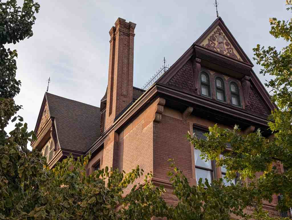
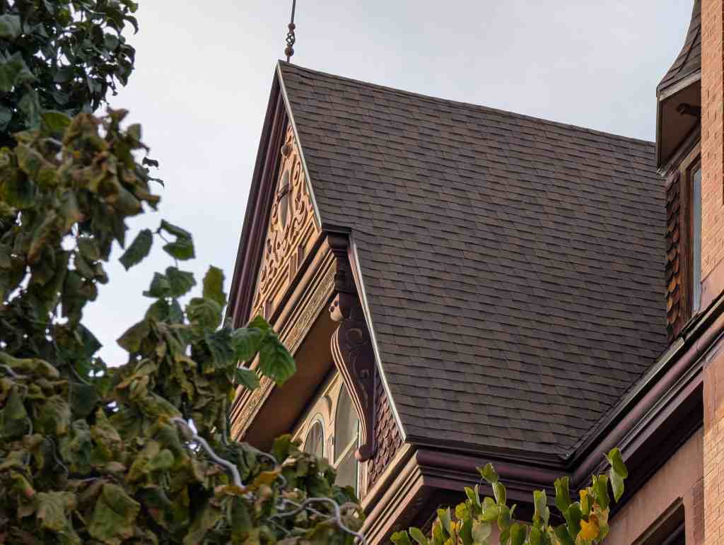
Mentioned in the national register’s nomination form: While they account for less than one percent of all residences, the very large, often architect-designed homes in the Eastlake, Queen Anne and Shingle styles, and later the Prairie and Craftsman styles greatly influence the visual character of the Avenues. Some of the state’s best examples of residential architectural styles were built there, including the William Barton house, 231 B Street, (vernacular/Gothic); the Jeremiah Beattie house, 30 J Street, (Eastlake); the David Murdock house, 73 G Street, (Queen Anne); the E.G. Coffin house, 1037 First Avenue, (Queen Anne); the N.H. Beeman house, 1007 First Avenue, (Shingle style); the Vto. Mclntyre house, 257 Seventh Avenue, (Classical Revival); the James Sharp house, 157 D Street, (Craftsman); and the W.E. Ware house, 1184 First Avenue, (Colonial Revival).
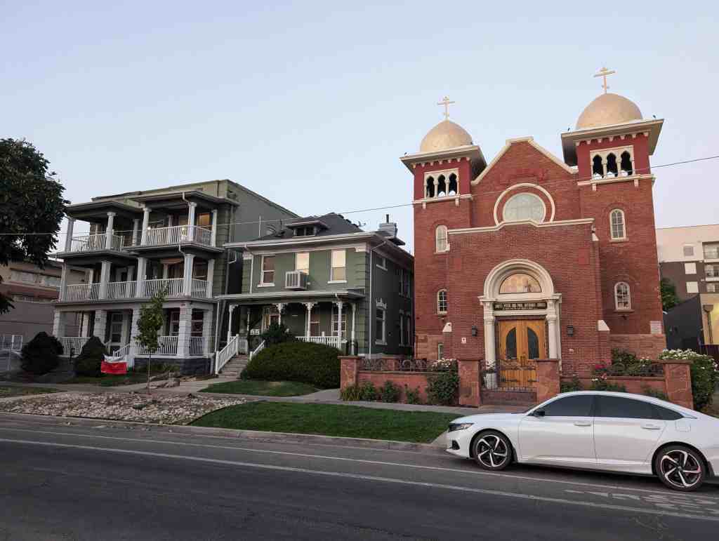
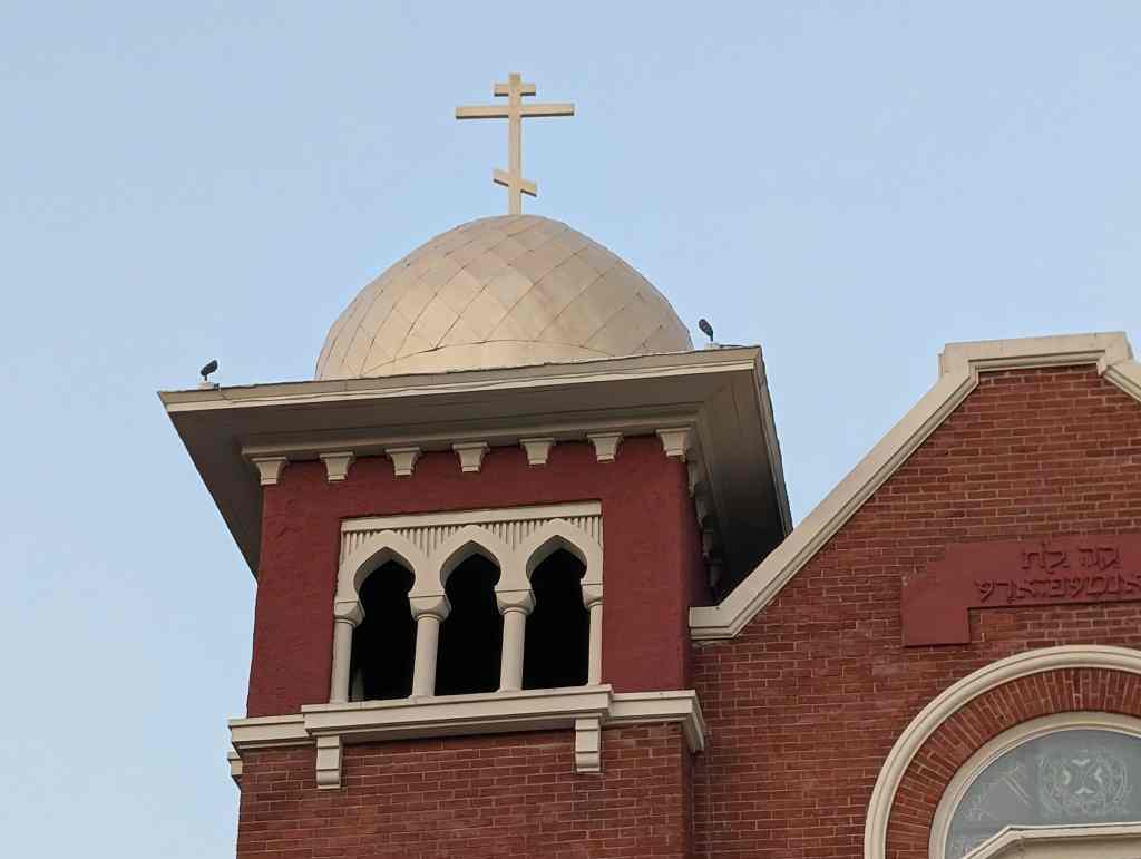
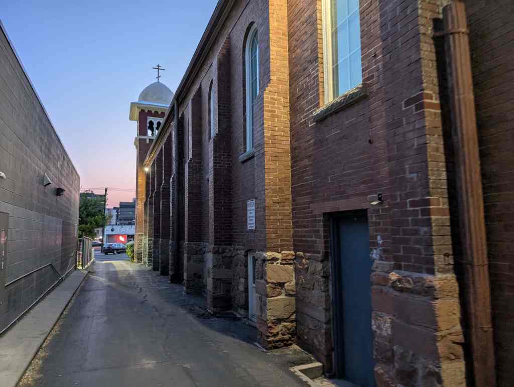
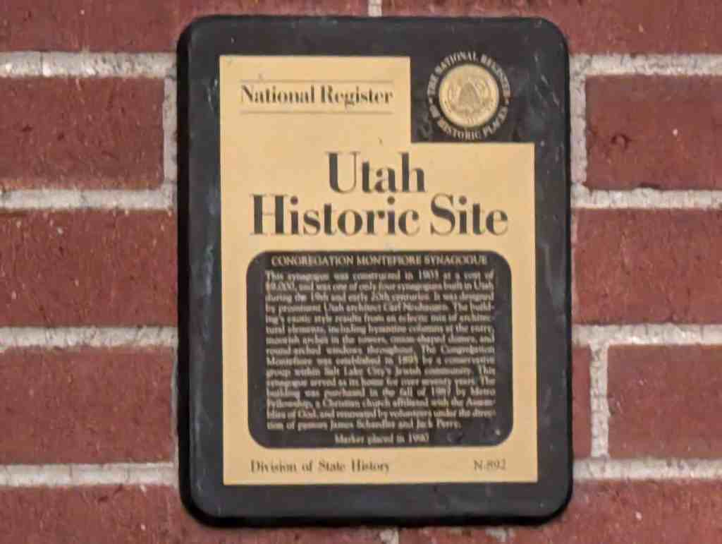
This Synagogue was constructed in 1903 at a cost of $9,000, and was one of only 4 synagogues built in Utah during the 19th and early 20th centuries. It was designed by prominent Utah architect Carl Neuhausen. The building’s exotic style results from an eclectic mix of architectural elements, including Byzantine columns at the entry, Moorish arches in the towers, onion-shaped domes, and round-arched windows throughout. The Congregation Montefiore was established in 1895 by a conservative group within Salt Lake City’s Jewish community. This Synagogue served as its home for over 70 years. The building was purchased in the fall of 1987 by Metro-Fellowship, a Christian Church affiliated with Assemblies of God, and renovated by volunteers under the direction of Pastors James Schaedler and Jack Perry.
The Synagogue is located at 355 South 300 East in Salt Lake City, Utah and was added to the National Register of Historic Places (#85001395) on June 27, 1985.
Text below is from the national register’s nomination form:
The synagogue of the Congregation Montefiore is significant for its association with Utah’s conservative Jewish population. The third Jewish house of worship to be constructed in two decades, the 1903 Moorish Revival synagogue is testimony to the diversity in religious practices within Utah’s Jewish community. The conservative or ‘Modern Orthodoxy,’ as it was then known, grew in numbers as a direct result of Utah’s development from territory to statehood. As Utah became part of the nation, national trends in emigration acted towards augmenting Utah’s Jewry, particularly in the conservative fold.
Since 1884 when Issidore Morris left the congregation B’nai Israel in disagreement over the adoption of the Reform practices, tradition oriented Utah Jews have met to celebrate festivals and holidays. Usually they met in members’ homes because their numbers were too few to support a synagogue. An 1892 estimate placed the entire Utah Jewish population at 1,050, over half of which were conservatives. The conservatives appealed to the Board of B’nai Israel to use their new synagogue for traditional services to no avail. Yet, the financial situation at B’nai Israel was so desperate by 1895 – they had gone through three rabbis in three years and were then without one—that a motion to dissolve the congregation was raised. The incident is indicative of the animosity, real or imagined, which existed between the two groups. With their numbers growing as a direct result of the influx of Russian and eastern European immigrants, who were more likely than not to be traditional, the conservative population met in 1895 to incorporate as the Congregation Montefiore.
Named after the 19th Century British Jewish philanthropist, trouble shooter and financial adviser to the queen, Moses Montefiore, the congregation planned to raise another synagogue in Utah. They were given a parcel of land by their fellow congregant, Morris Levy, located on Third East between Third and Fourth South in Salt Lake City. With the cornerstone laid in August, 1903, in the presence of L.D.S. Church President Joseph F. Smith, it was largely the completed by the end of the year. The building was designed by local Salt Lake architect Carl Neuhausen and cost $9,000. The benign respect extended by Mormon authorities towards particularly Montefiore’s members was a way of thanking the Jews for Issidore Morris’ key role in securing the release from the federal penitentiary of Mormon polygamous Bishop William Smith. The congregation was financially aided by the Mormon church which gave $2,000 toward the construction of this building. Built without central heat, the basement was also unfinished. The congregation joined the United Synagogues of America National Union in 1966. Finally in 1972 the congregation voted for merger with B’nai Israel. An addition housing religious school activities was added to the rear after World War II.
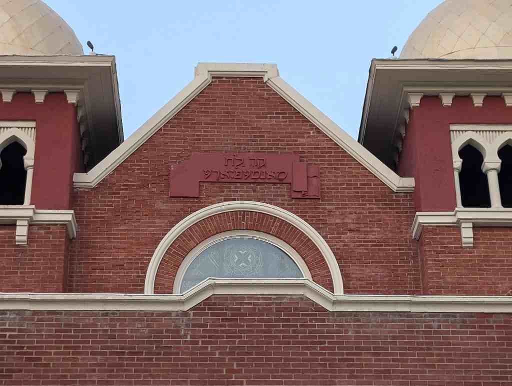
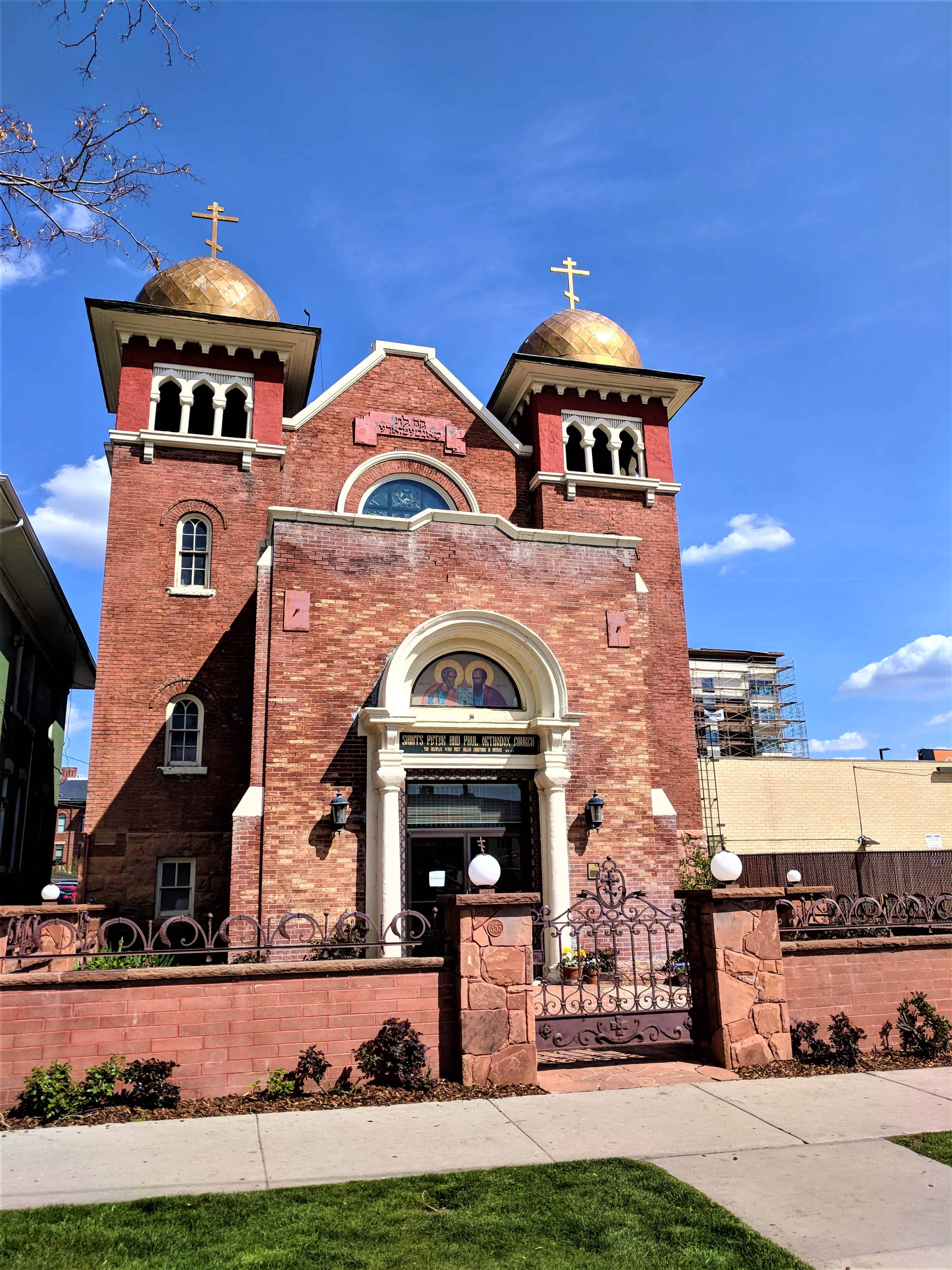
The synagogue is a long rectangular building, the primary portion of which is defined by brick gabled walls facing east and west. The north and south walls, also of brick which appear to have been painted from the start are divided into nine bays – each containing a tall round arched window – by projecting pilasters. It is not known whether the pilasters serve to brace load bearing walls or whether they conceal steel columns which in turn might be attached to steel roof trusses. At both ends of the west facade are square towers with onion shaped domes atop broad bracketed cornices below which are arcades of Assyrian arches on columns. The tower shafts are brick; their bases and the entire original building base is of rusticated Ashlar stone, to the water table. In the center of the east gable wall is a metal plaque with a raised Hebrew inscription. Below the plaque is a round window with a six-pointed star pattern. Below this is a projecting entry vestibule with a flat roof and parapet walls. The west wall of the vestibule has an elaborate entrance composed of double doors surmounted by a transom and flanked by Byzantine columns which support a projecting semi-circular pediment. The Tympanum is glass, with diagonal and horizontal divisions. The rear addition is of masonry construction, probably with a steel frame. There is a flat roof on steel bar joists. The brick is the same color as the painted brick on the original building. The brick vestibule on the facade is an early, well-matched addition.
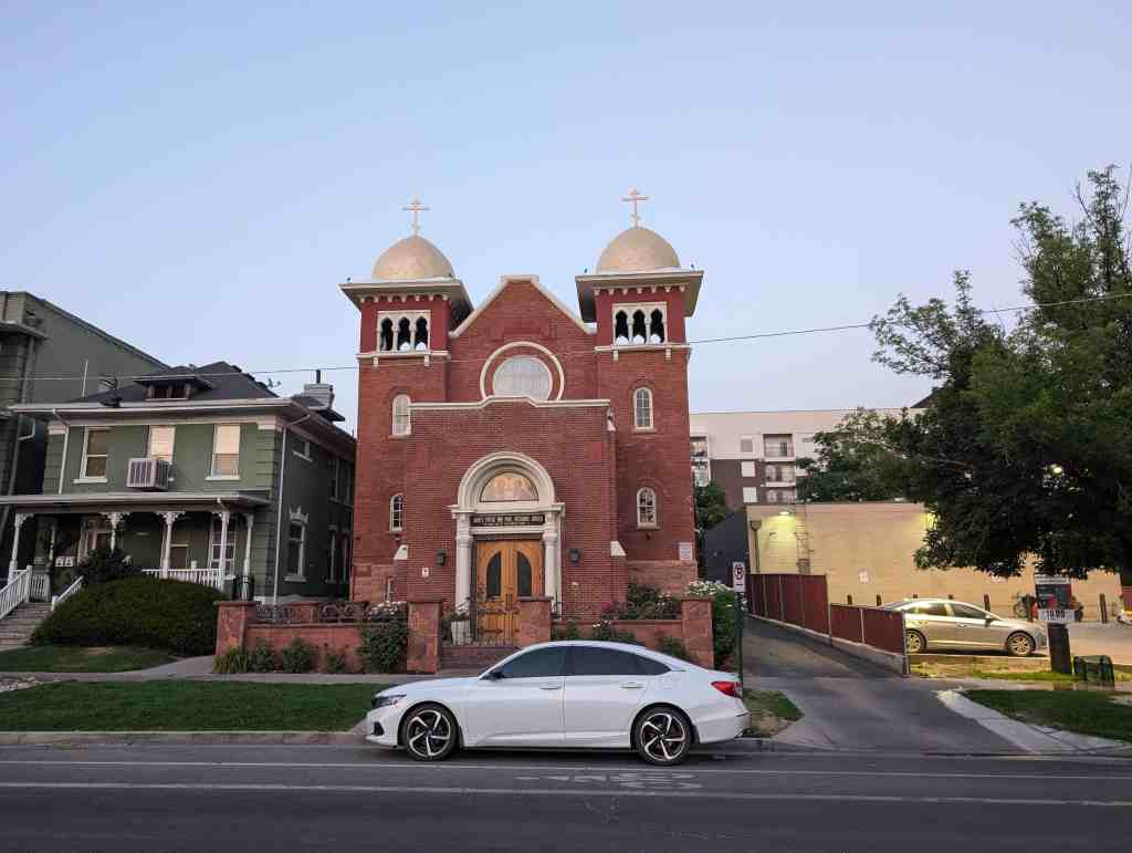
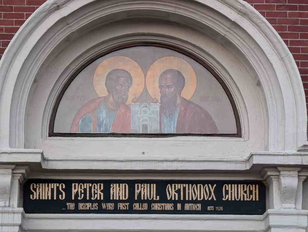
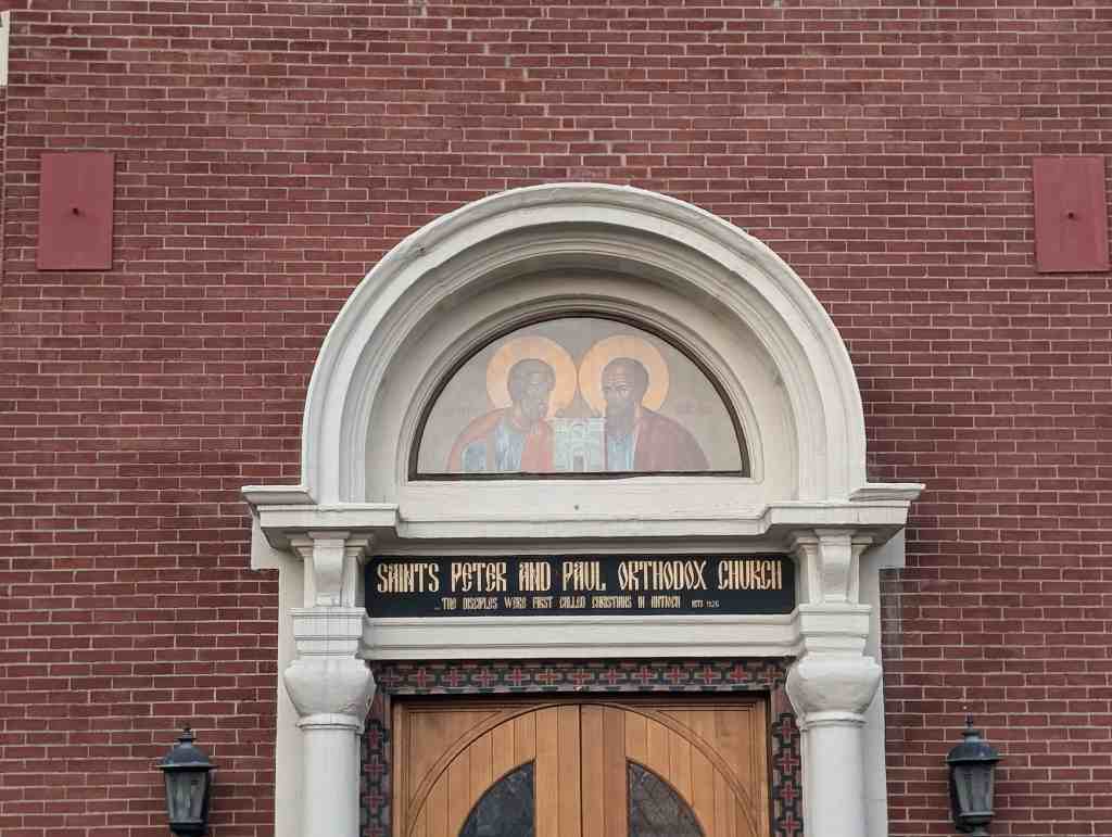
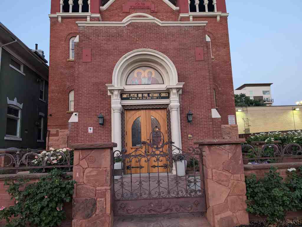
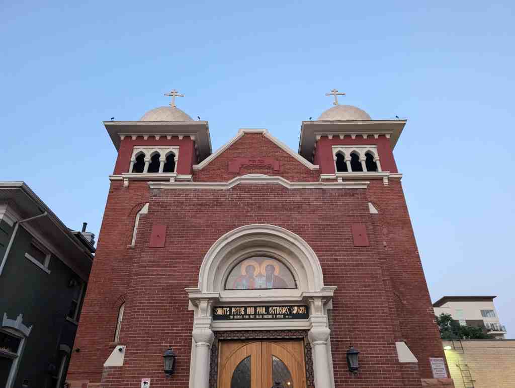
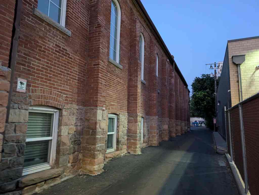
Saints Peter and Paul Orthodox Church
Saints Peter and Paul Orthodox Church
For other Historic Churches in Salt Lake City visit this page.
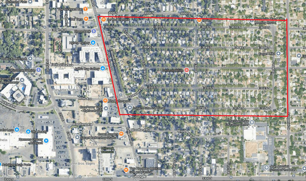
The Mountair Acres Subdivision Historic District (hereafter referred to as Mountair Acres) is one of Millcreek’s earliest subdivisions, composed of approximately 75 acres along Highland Drive, a major commercial corridor between Salt Lake City and Millcreek. While the neighborhood started as a rural area, it was acquired and mined for its high natural clay content by the Salt Lake Pressed Brick Co. The subdivision was first platted in 1939 with construction starting in 1940. Several model homes were available for viewing, including a collaboration with Montgomery Ward. Over the next nine years, the subdivision was platted and construction completed in 1952 with all lots built and sold. Design of Mountair Acres added the flair of a curved street, Crescent Drive, as a key focal and circulation point that set it apart from traditional grid subdivisions. Use within Mountair Acres is completely single-family residential. Character-defining features of the district include uniform setbacks, landscaping with mature trees in the park strip, grass lawns, rear garages, and one story buildings. There are a total of 709 resources in the Mountair Acres Subdivision Historic District with three architectural styles within the period of significance (1940-1959). Contributing buildings number 523 (74%), while there are 186 (26%) non-contributing resources, including one (<1%) non-contributing site. The 709 resources break down to 374 (53%) primary resources and 334 (47%) secondary resources. Within the category of primary buildings, the integrity numbers remain strong with 307 (82%) contributing and 67 (18%) non-contributing. Despite limited square footage and location near Salt Lake City, the neighborhood has not been a target for teardowns for larger houses to the present date which has led to a high degree of retained integrity in all seven areas.
The text on this page is from the nomination form for the national historic register.
The Mountair Acres Subdivision Historic District is located in the city of Millcreek, Salt Lake County, Utah. Millcreek is a suburb located immediately south of Salt Lake City. Topographically, Millcreek consistently rises in elevation west to east, from the valley floor, to the east bench, and into the foothills. The city is named for the Mill Creek, which runs east-west and is located south of Mountair Acres approximately one-half mile.
Following the general topography of the community, the original topography of the Mountair Acres subdivision site was slightly sloped rising west to east. It’s ownership and use by the Salt Lake Pressed Brick Company excavated several feet of natural clay deposits from the site, lowering the overall topography and creating a man-made shelf on the eastern boundary of the neighborhood. However, the 75 acres that comprise Mountair Acres today is flat in topography.
The neighborhood was platted with a layout of streets that broke from the earlier typical cardinal grid pattern of Salt Lake City, known as the Plat of the City of Zion. The west boundary of the subdivision aligns with Highland Drive, one of the few early diagonal roads in the valley.1 A linear park that runs parallel to Highland Drive separates the subdivision from the road traffic. Originally, a row of bushes was planted within the park area and grew over 10 feet high, serving as a landscape buffer. Mountair Drive runs parallel to Highland Drive and the park. Behind Mountair Drive is Crescent Drive which is aptly named as it curves north to south. Each of the five east-west streets intersects with Crescent Drive as it serves as the connecting point for the subdivision on the west. On the east, 1640 East is the connecting point with all east-west streets intersecting. In the center of the subdivision, 1500 East serves as a circulation street that runs north-south to break up the east-west blocks. No alleys exist with driveway access coming directly from the street to the side of each house. There are three entry/exit points to the subdivision: Gregson Avenue on the east leading to Imperial Avenue (1700 East), and 3010 South and Crescent Drive on the west leading to Highland Drive.
Development of the Mountair Acres Subdivision was spread out over 12 years and seven separate plats with the majority of construction occurring in 1948 when 126 houses were built. One additional house – 3004 S. Imperial Street – was constructed in 1959 but is located at the edge of the subdivision and is the only resource on Imperial Street. While the first year of subdivision development resulted in 13 houses constructed, there were seven subsequent years when at least 20 houses were built within a year.
Architectural Styles, Building Types, and Materials In Mountair Acres, the subdivision’s consistent appearance and visual character stems not only from the mature trees that line its streets, but also the use of similar architectural style. Many of the buildings exhibit characteristics of Ranch style buildings, but were not designed as Ranch or Early Ranch buildings; therefore, being categorized as Minimal Traditional in style. A single resource, categorized as Other, is a park.
Minimal Traditional The Minimal Traditional-style residences, as the name suggests, exhibit an overall simplicity of form and architectural detail, lending these characteristically small houses the appearance of maximum size. McAlester details the style’s additional features to include a “Low- or intermediate-pitched roof, more often gabled; small house, generally one-story in height; roof eaves usually have little or no overhang; double-hung windows, typically multi-pane or 1/1; minimal amounts of added architectural detail; rarely has dormers.” There are 66 examples of the Minimal Traditional style with a range of construction dates between 1940-1952. Fifty-three (80%) of the examples are contributing while 13 (20%) are non-contributing. Examples of the Minimal Traditional style include 1602 East 3115 South and 1387 East 3010 South.
Ranch The identifying features of the Ranch style according to McAlester include a “Broad one-story shape; usually built low to ground; low-pitched roof without dormers; commonly with moderateto-wide roof overhang; front entry usually located off-center and sheltered under main roof of house; garage typically attached to main façade (faces front, side, or rear); a large picture window generally present; asymmetrical façade.” In the district, there are 308 examples of the Ranch style, including the Early Ranch. Their dates of construction are between 1940-1959. Contributing resources number 253 (82%) examples of the style and non-contributing examples number 54 (18%). Examples of the Early Ranch style include 1625 East 3150 South, 1626 East 3010 South, 3021 S. Mountair Dr., 1424 East 3115 South, 1495 East 3010 South, 1414 East 3010 South, and 1368 East 3010 South.
The single example of the Ranch style rambler is located at 3004 S. Imperial St. and was constructed in 1959. The term rambler is often used interchangeably with the Ranch style, but can denote a derivation featuring an attached garage and elongated façade.
Materials Much like the architectural styles and building height within Mountair Acres, the construction materials are also overwhelmingly consistent, with brick being the main construction material for 93% (348) of the primary buildings. Veneers compose 21 of the buildings (5%) and there are five wood buildings. (2%).The one Other/Undefined resource is the park.
Common Characteristics and Variations The houses are roughly the same size, 600-800 square feet on the main level, lending to the visual cohesion of the neighborhood. This size was based on the Federal Housing Administration (FHA) “minimum house” standards developed in the mid-1930s as part of the National Housing Act. The standards also made recommendations for floor plans and stylistic elements. Two years later, new recommendations were added to the standards for construction quality and equipment.
The three styles share common features. Because no original floor plans exist, the primary buildings are compared by their exterior appearances. This includes bay windows, circular windows, corner (or meeting) windows, and picture windows. There are many more asymmetrical forms (331; 89%) than symmetrical (43; 11%). Another method to compare variations is through roof types. Roof types vary greatly from side gable examples and side gable variations (225; 60%) and hipped examples and hipped variations (147; 39%), cross gabled forms (2; 1%).
The roof type or form alone do not distinguish the style as common characteristics were blended between all styles and forms. The evidence of these common characteristics demonstrates how the transition of styles led to blending of ideas. In dozens of examples, multiple features such as these were also utilized together. For example, the house at 3009 S 1640 E is an example with a bay window and circular window with a hipped roof. At 1517 East 3045 South is a house the is symmetrical with two corner (meeting) windows and center door on the main façade with a hipped roof. An example with a bay window and picture window under a side gabled roof is located at 1449 East 3010 South. The unique combination of a circular window, picture window, and corner (meeting) window are included on the house at 1517 East 3010 South.
Variations of styles begin with roof forms and symmetry. Using these as a basis of the design, various arrangements of window openings were applied in over a dozen different arrangements. Some of these may have been based on floor plan while others on personal choice and budget. Symmetrical variations include the side gable version at 3079 S. Mountair Dr. and hipped roof version at 1517 East 3045 South. Asymmetrical variations include the side gable version at 3025 S. Crescent Dr. and the hipped roof version at 3023 South 1640 East. There are a few limited variations that have more complex roof forms including the intersecting hipped roof with front gable accents and attached garage at 3046 S. Crescent Dr., the multiple intersecting hipped roofs of the house at 1415 East 3010 South, and the complex roof form at 1495 East 3010 South.
Outbuildings There are a total of 364 secondary buildings (outbuildings) within the historic district boundary. Unattached one bay garages are the most numerous at 196 (59%) followed by unattached two bay garages 117 (32%), there are 20 sheds (5%), and one unattached carport (1%). Examples of sheds include 1524 East 3045 South, 1559 East 3010 South, 3026 S. Crescent Dr., and 1424 East 3045 South. Out of the 334 total outbuildings, 216 are contributing to the historic district: unattached one bay garages number 157, unattached two bay garages number 53, and six contributing sheds. Material variations within the single bay are attached, unattached brick, unattached wood, unattached with shed, and unattached with half story above. Material variations within the double bay are brick, concrete block, and wood. Examples of variations within the single bay category include 1443 East 3010 South (wood;, 1560 East 3010 South (brick; Photo 28), 1631 E. Gregson Ave. (stucco;, 1571 East 3010 South (flat roof;, 1639 East 3010 South (with shed;, and 1566 East 3010 South (with carport;. Examples of variations within the double bay category include 3052 South 1640 East (brick;), 1547 East 3150 South (concrete block; Photo 34), and 1583 East 3045 South (half story above;. The single unattached carport is located at 1489 East 3115 South. Examples of flat-roof carports are found at 1526 E. Gregson Ave. and 1524 S. Gregson Ave. Angled carports are located at 3040 S. Crescent Dr. and 3059 South 1640 East.
Change over Time and Historic Integrity The Mountair Acres Subdivision Historic District retains a high degree of the seven aspects of integrity as detailed by the following:
There were no vacant lots left from the time of the subdivision’s original platting and none exist currently. The block divisions, parcel sizes, and original construction on each lot has remained intact for the majority of properties. Zero intrusions exist as there have not been any teardowns and new construction. Only one house has made an incompatible addition to the top of an original one-story building. Additions, when constructed, have commonly happened behind the house. The majority of garages date to the historic period. New (out of period) garages have typically been placed in the same rear corner lot position as garages have been historically located and remained one story in height. The original park between Mountair Drive and Highland Drive was redesigned and renovated in 2020 with new landscaping and a sidewalk.
Five houses retain one or more original windows. These are located at 1494 East 3045 South, 1505 East 3045 South, 1420 East 3150 South, 1482 East 3150 South, and 1536 East 3150 South.
Location The aspect of location integrity is intact as the neighborhood remains built in its original location and no buildings have been moved in or out of Mountair Acres. The boundary for Mountair Acres follows the boundaries of the seven original subdivision plats between 1939 and 1948. The streets remain in their original design and lot sizes have remained constant with none being combined or subdivided further.
Design The overall design of the Mountair Acres Subdivision’s streets, blocks, lots, and yards hold integrity with very few changes since the original platting and construction. Throughout the entire neighborhood, original sidewalks and front yards remain intact. Garages are located at the rear of each property and accessed by long driveways from the street. Except in a few cases when the garage is located on the street for a corner property. Trees in the front yards on every street have matured for several decades creating a natural canopy for the neighborhood. Modest front yards between the sidewalk and the buildings have been maintained and remain contiguous, typically not separated by fences, giving a consistent look along the streetscape.
The design of individual buildings is a narrow representation of styles that were becoming popular nationally at the outset of World War II.
Despite the Salt Lake City area being a strong real estate market over the last 25 years, the neighborhood has resisted the teardown epidemic that other neighborhoods have had to face. However, alterations to individual residences have been frequent in the last 50 years. The most frequent changes have been exterior alterations such as window, roof, and sheathing replacements. Several buildings exhibit additions. While the majority of additions to historic buildings in the district are located at the rear and thus are compatible with both original construction and the context of the neighborhood as a whole, a few non-contributing examples are notable for their poor design and/or location on the building.
Setting Surrounding Mountair Acres are distinctive neighborhoods of their own. To the west is the Highland Drive commercial district. To the north and south are neighborhoods of later construction dates and varied integrity. To the east is a neighborhood of mixed construction date, between 1920 and 2024, with varied integrity and less distinctive architectural consistency.
Within the physical environment of Mountair Acres, however, is strong integrity of the original buildings as well as the developed setting around the buildings. The original sidewalks remain intact in their original locations and at their original sizes. Trees, front yards, and other vegetation have matured for several decades, creating the garden-like natural environment within the neighborhoods. Few chain link fences are present in front yards.
Materials The dominant building material within Mountair Acres is brick, utilized for both structure and exterior material. This is a dominant characteristic of contributing buildings and thus retain their integrity in this aspect. These materials have deeper significance as they were created by the Salt Lake Pressed Brick Company from some of the same clay on which the subdivision sits. Other construction materials include wood (structural framing and sheathing). If changes have occurred, most often that was in the form of new windows in aluminum or vinyl materials. While many wood buildings retain their original sheathing, many have been covered with aluminum or vinyl siding. Occasionally, a roof was replaced with new materials that were not historic, such as metal (aluma-lock) or rubber shingles replacing asphalt shingles. Dozens of houses have added a small porch over the original stoop, but in most cases do not detract from the historic appearance or create permanent alterations.
Workmanship Mountair Acres is unique in Salt Lake County as an example of a neighborhood built over a relatively short period of time with a narrow array of architectural styles that has retained its overall historic character. The workmanship invested in the craftsmanship of the buildings within Mountair Acres remains evident in the styles, forms, and details, even when some materials may have changed.
Feeling Mountair Acres’ consistent setback and scale, consistency of historic styles, retention of historic outbuildings, and associated landscape elements all contribute to its strong integrity of feeling as an early-to-mid-twentieth century residential neighborhood.
Association Through the retention of its historic layout, scale, architectural features, and materials, Mountair Acres clearly conveys its historic associations with the early mid-twentieth century architectural development within Salt Lake County.
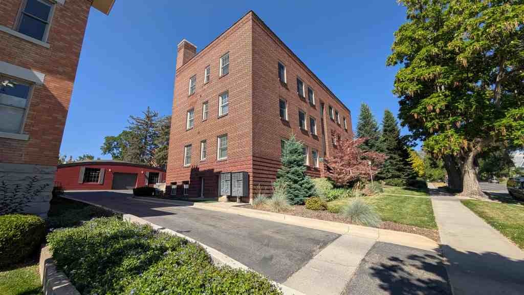
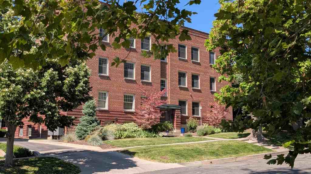
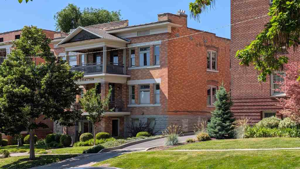
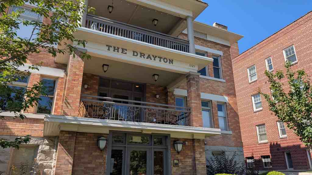
In 1938, Albert H. Walsh hired the Fullmer Bros. Construction Company to build this large, three-story brick apartment building, featuring 18 units. Albert Walsh was the founder of the A.H. Walsh Plumbing Company, and the company’s office building was located on the same block as the apartments. Mr. Walsh resided nearby at 1120 East 2nd Avenue. The apartment building retains its historic and architectural integrity and is a contributing resource within the Avenues Historic District.
Constructed circa 1908, this three-story, brick apartment building was likely constructed by John H. Hilton and in 1916 was sold to Albert H. Walsh. Albert Walsh was the founder of the A.H. Walsh Plumbing Company. Mr. Walsh resided nearby at 1120 East 2nd Avenue and he owned the apartment building through 1950. The building was constructed at a time when an increasing number of multi-family structures were being built in the Avenues, transitioning away from single-family, owner-occupied residences. It features a prominent, centrally located pedimental bay for the front entry and large balconies.
Constructed circa 1913, this three-story, brick apartment building was constructed by Albert H. Walsh and named for his wife, Emma N. Walsh. Albert Walsh was the founder of the A.H. Walsh Plumbing Company. The building was built at a time when an increasing number of multi-family structures were being built in the Avenues, transitioning away from single-family, owner-occupied residences. Character defining features of the building include its centrally located stairs and central hallway, sandstone foundation, and its front porch with massive two-story Doric columns and decorative entablatures.
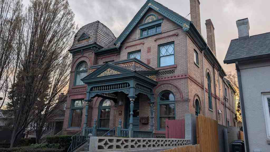
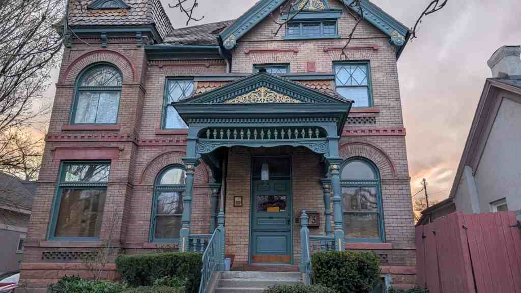
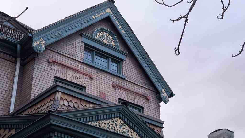
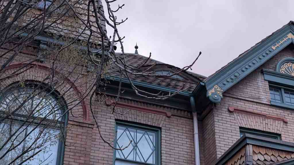
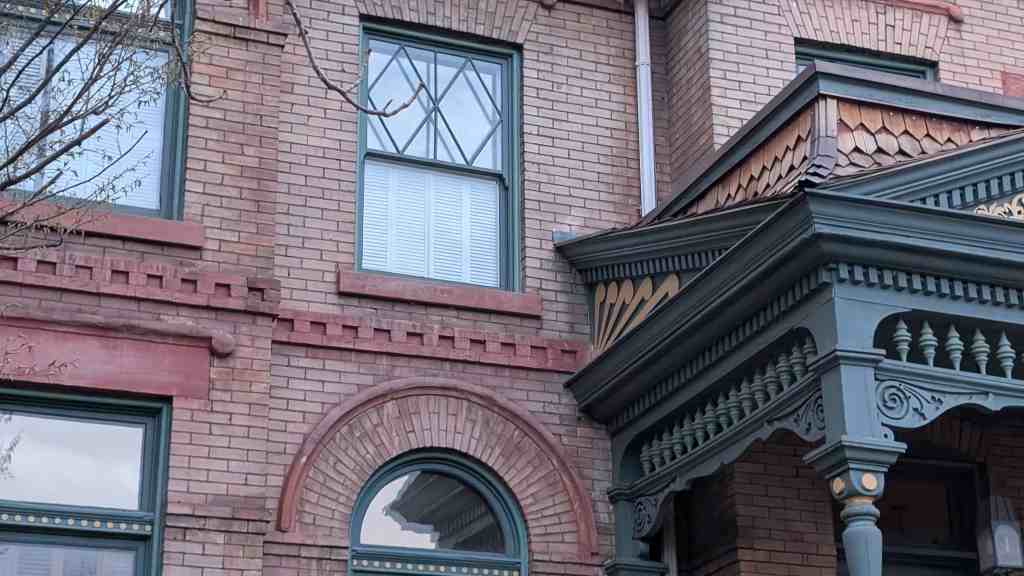
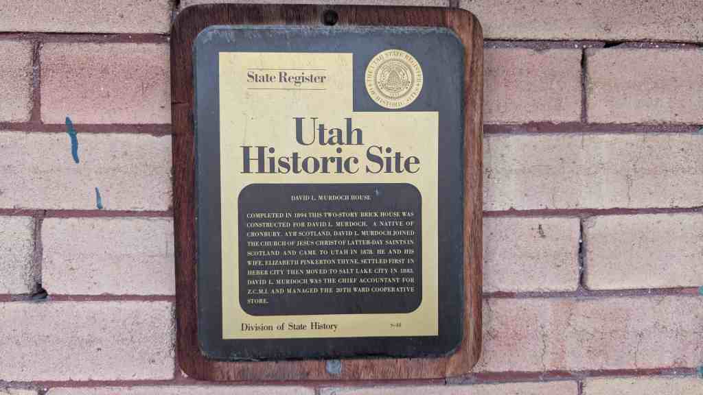
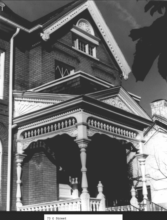
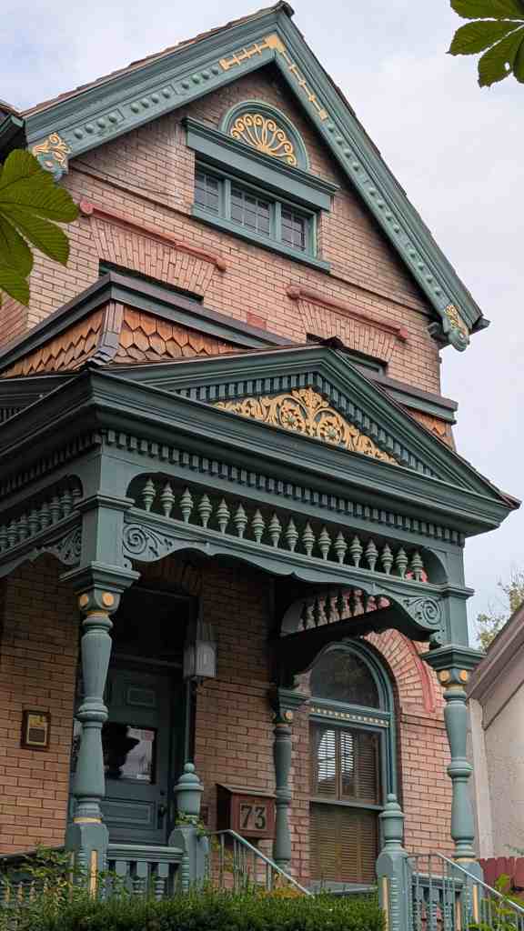
Completed in 1894 this two-story brick house was constructed for David L. Murdoch. A native of Cronbury, Ayr Scotland, David L. Murdoch joined The Church of Jesus Christ of Latter-day Saints in Scotland and came to Utah in 1878. He and his wife, Elizabeth Pinkerton Thyne, settled first in Heber City then moved to Salt Lake City in 1883. David Lennox Murdoch was the Chief Accountant for Z.C.M.I. and managed the 20th Ward Cooperative Store.
The nomination form for the national historic register mentioned the home here: While they account for less than one percent of all residences, the very large, often architect-designed homes in the Eastlake, Queen Anne and Shingle styles, and later the Prairie and Craftsman styles greatly influence the visual character of the Avenues. Some of the state’s best examples of residential architectural styles were built there, including the William Barton house, 231 B Street, (vernacular/Gothic); the Jeremiah Beattie house, 30 J Street, (Eastlake); the David Murdock house, 73 G Street, (Queen Anne); the E.G. Coffin house, 1037 First Avenue, (Queen Anne); the N.H. Beeman house, 1007 First Avenue, (Shingle style); the Vto. Mclntyre house, 257 Seventh Avenue, (Classical Revival); the James Sharp house, 157 D Street, (Craftsman); and the W.E. Ware house, 1184 First Avenue, (Colonial Revival).
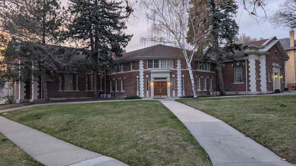
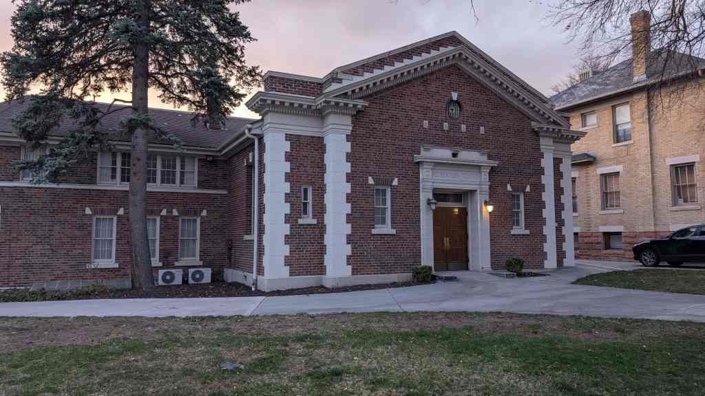
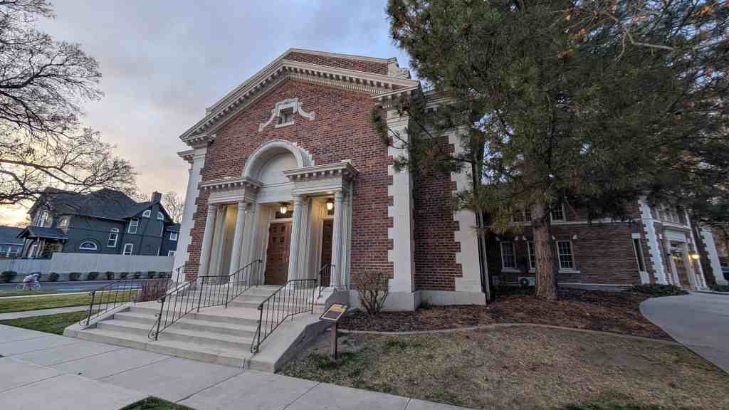
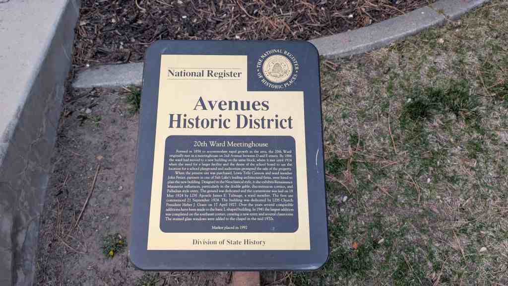
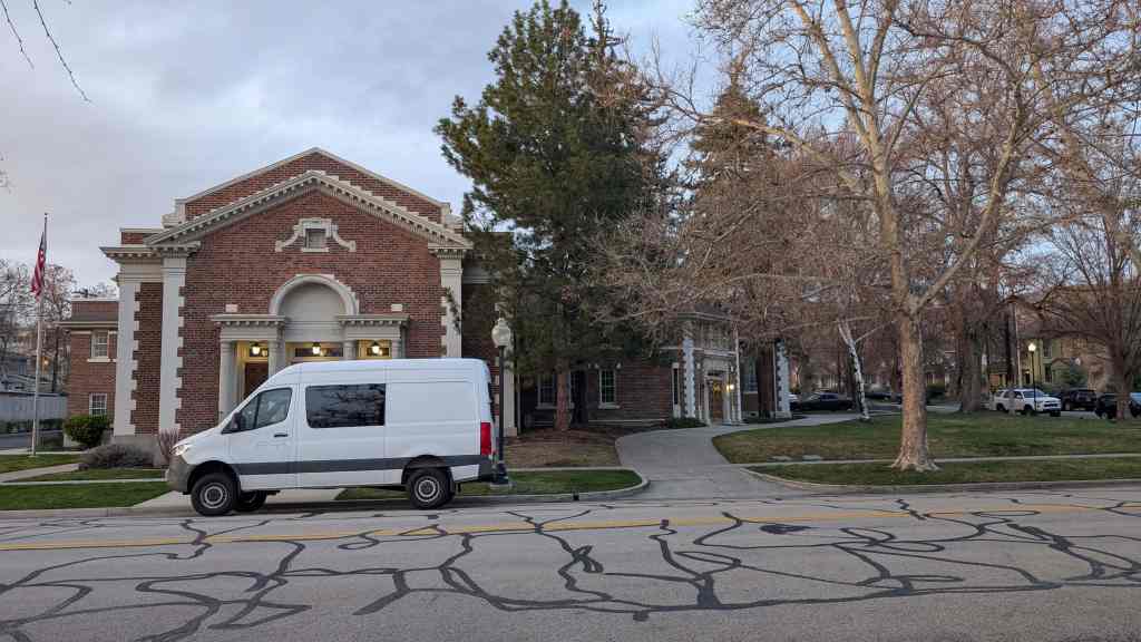
Formed in 1856 to accommodate rapid growth in the area, the 20th Ward originally met in a meetinghouse on 2nd Avenue between D and E streets. By 1884 the ward had moved to a new building on the same block, where it met until 1924 when the need for a larger facility and the desire of the school board to use the location for a school playground and auditorium prompted the sale of the property.
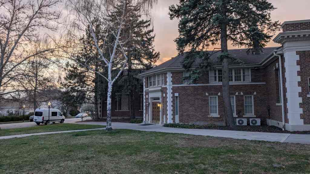
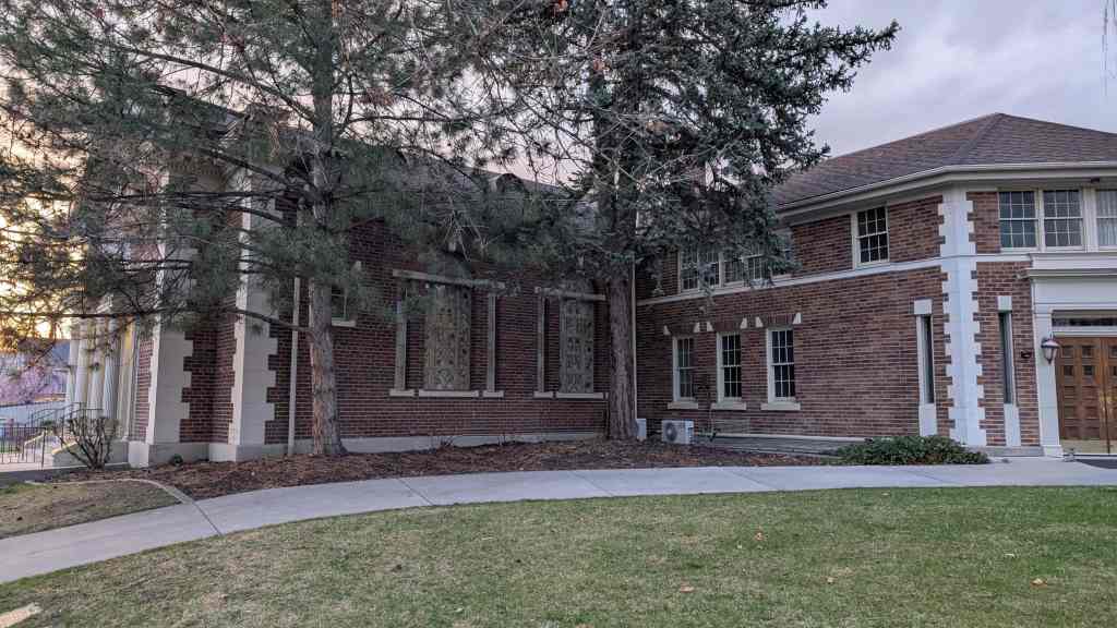
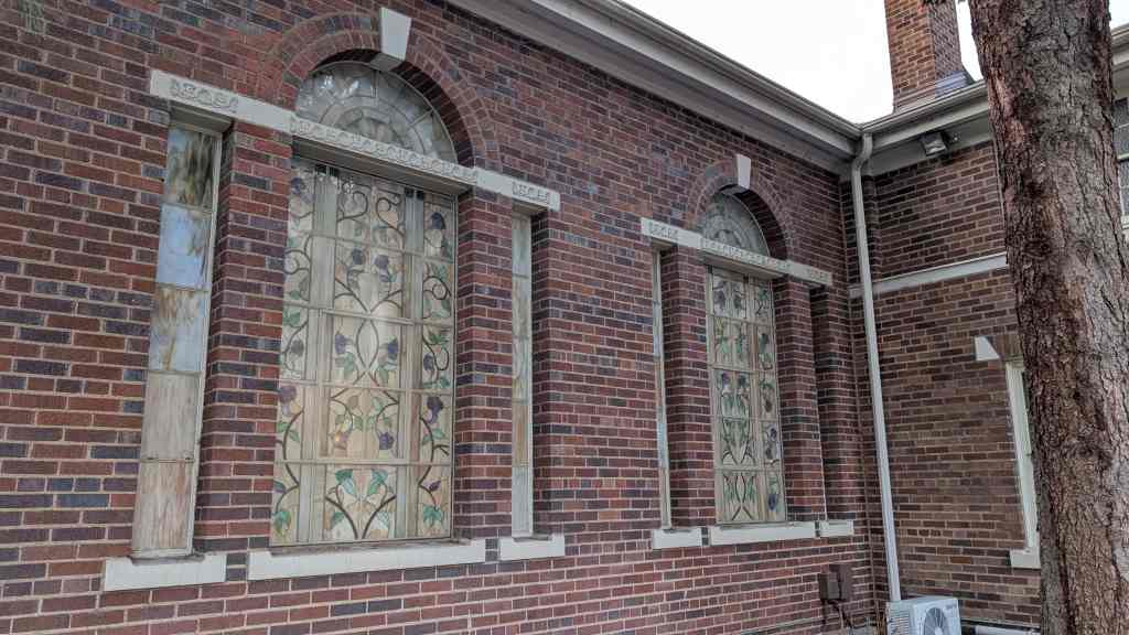
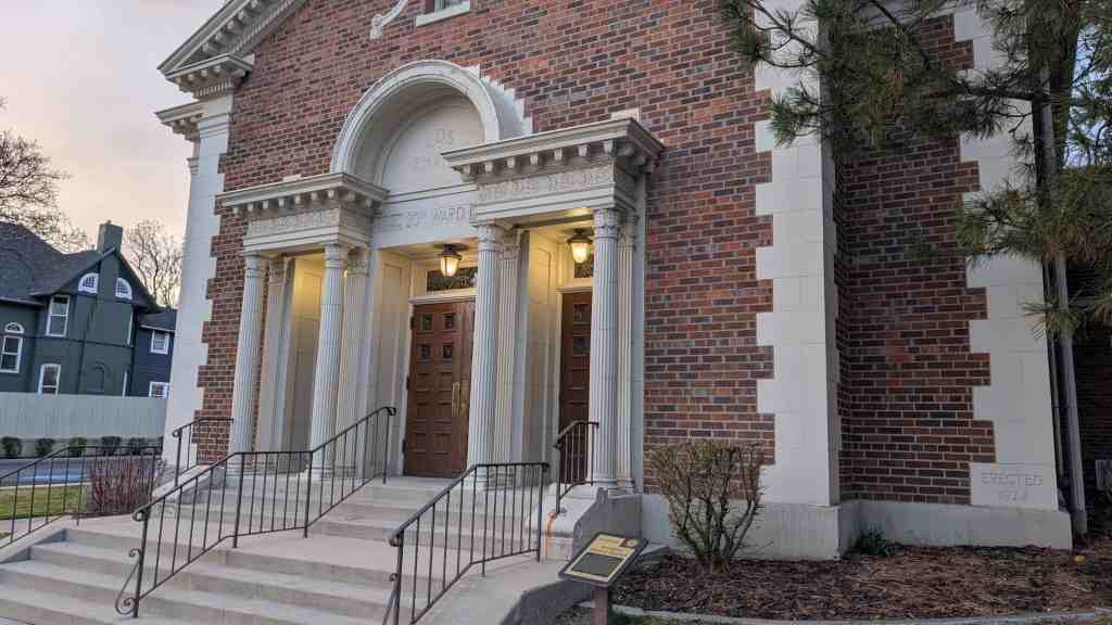
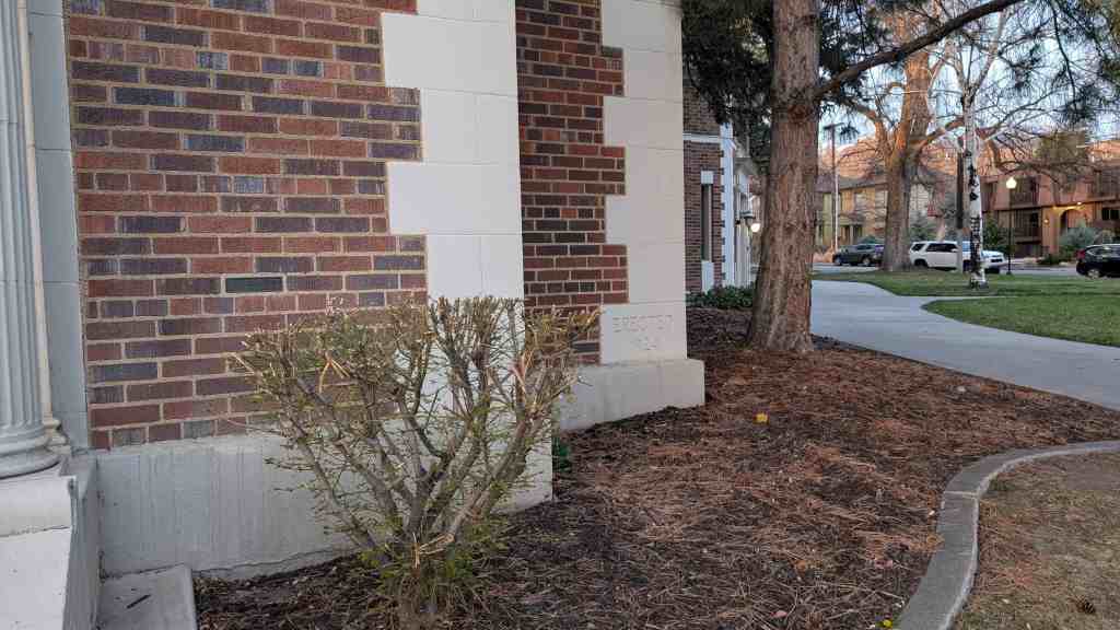
When the present site was purchased, Lewis Telle Cannon and ward member John Fetzer, partners in one of Salt Lake’s leading architectural firms, were hired to plan the new building. Designed in the Neoclassical style, it also exhibits Renaissance Mannerist influences, particularly in the double gable, discontinuous cornice, and Palladian style entry. The ground was dedicated and the cornerstone was laid on 18 May 1924 by LDS Apostle James E. Talmage, a ward member. The first use commenced 21 September 1924. The building was dedicated by LDS Church President Heber J. Grant on 17 April 1927. Over the years several compatible additions have been made to the basic L-shaped building. In 1941 the largest addition was completed on the southeast corner, creating a new entry and several classrooms. The stained glass windows were added to the chapel in the mid 1970s.
Preservation Utah‘s “Kletting in the Avenues” Historic Homes Tour said: The design of the Twentieth Ward Meetinghouse reflects a significant shift in how the LDS Church built its meetinghouses. During the 19th century, church buildings were designed and built almost entirely by individual wards with each function (chapel, recreation hall, Relief Society building, bishop’s storehouse, tithing office, et al) occupying its own building. But by the 1920s, when this building was constructed, the design of meetinghouses was becoming increasingly standardized, primarily to consolidate those various functions. Although its general layout may have been standardized, the design of the Twentieth Ward Meetinghouse showcases the high level of design available in the early 20th century to middle class wards with extra funds. The meetinghouse was designed by the firm of Cannon and Fetzer, which designed other notable buildings in Salt Lake, including the Park Building at the University of Utah and West High School.